CN102682572A - Wireless sensor network positioning-based intelligent person nursing method - Google Patents
Wireless sensor network positioning-based intelligent person nursing method Download PDFInfo
- Publication number
- CN102682572A CN102682572A CN2012100835168A CN201210083516A CN102682572A CN 102682572 A CN102682572 A CN 102682572A CN 2012100835168 A CN2012100835168 A CN 2012100835168A CN 201210083516 A CN201210083516 A CN 201210083516A CN 102682572 A CN102682572 A CN 102682572A
- Authority
- CN
- China
- Prior art keywords
- node
- location
- coordinate
- nodes
- positioning
- Prior art date
- Legal status (The legal status is an assumption and is not a legal conclusion. Google has not performed a legal analysis and makes no representation as to the accuracy of the status listed.)
- Granted
Links
- 238000000034 method Methods 0.000 title claims abstract description 52
- 230000000474 nursing effect Effects 0.000 title claims description 7
- 230000007613 environmental effect Effects 0.000 claims description 14
- 238000009434 installation Methods 0.000 claims description 4
- 230000007958 sleep Effects 0.000 claims description 4
- 238000013461 design Methods 0.000 claims description 3
- 238000012546 transfer Methods 0.000 claims description 2
- 230000005540 biological transmission Effects 0.000 claims 2
- 231100001261 hazardous Toxicity 0.000 claims 2
- 241000238876 Acari Species 0.000 claims 1
- 230000004888 barrier function Effects 0.000 claims 1
- 238000005286 illumination Methods 0.000 claims 1
- 230000004807 localization Effects 0.000 claims 1
- 238000005259 measurement Methods 0.000 claims 1
- 238000005065 mining Methods 0.000 claims 1
- 230000000644 propagated effect Effects 0.000 claims 1
- 238000012545 processing Methods 0.000 abstract description 3
- 238000005265 energy consumption Methods 0.000 abstract description 2
- 238000005516 engineering process Methods 0.000 description 7
- 238000010586 diagram Methods 0.000 description 4
- 230000005059 dormancy Effects 0.000 description 4
- 238000004891 communication Methods 0.000 description 3
- 230000004044 response Effects 0.000 description 3
- 230000008054 signal transmission Effects 0.000 description 2
- 208000012260 Accidental injury Diseases 0.000 description 1
- 206010035148 Plague Diseases 0.000 description 1
- 241000607479 Yersinia pestis Species 0.000 description 1
- 230000032683 aging Effects 0.000 description 1
- 230000009286 beneficial effect Effects 0.000 description 1
- 230000002542 deteriorative effect Effects 0.000 description 1
- 230000004438 eyesight Effects 0.000 description 1
- 238000004377 microelectronic Methods 0.000 description 1
- 238000012544 monitoring process Methods 0.000 description 1
- 238000011160 research Methods 0.000 description 1
Images


Classifications
-
- Y02B60/50—
Landscapes
- Position Fixing By Use Of Radio Waves (AREA)
- Mobile Radio Communication Systems (AREA)
Abstract
传统的GPS定位在室内环境下定位造价昂贵并且GPS信号在室内传播时多径现象严重,不适合于室内定位。考虑到传感器网络在室内定位的优势,本发明提出了一种基于无线传感器网络定位的人员智能看护方法,以协助家庭看护老幼家庭成员。该方法一方面通过将传感器网络与以太网相连将数据处理交由定位服务器处理不仅增强了网络功能而且减少了传感器节点的网络能耗,另一方面该方法通过使用子区域划分,环境监测器等方式来达到环境适应的功能,提高定位的准确性,同时该方法采用投票选举以及信号强度的信息来求得目标节点的坐标,不需要依赖额外的硬件,经济方便。
The traditional GPS positioning is expensive in the indoor environment and the multipath phenomenon is serious when the GPS signal propagates indoors, so it is not suitable for indoor positioning. Considering the advantages of sensor network positioning indoors, the present invention proposes a method for intelligent personnel care based on wireless sensor network positioning to assist families in caring for old and young family members. On the one hand, this method not only enhances the network function but also reduces the network energy consumption of sensor nodes by connecting the sensor network to the Ethernet and handing over the data processing to the positioning server. This method achieves the function of adapting to the environment and improves the accuracy of positioning. At the same time, this method uses voting and signal strength information to obtain the coordinates of the target node. It does not need to rely on additional hardware and is economical and convenient.
Description
技术领域 technical field
本发明为基于无线传感器网络定位的人员智能看护方法,主要用来解决家庭成员在老人及儿童看护方面存在的一些问题,如人手不足以及由于不能实时跟踪看护和一时疏忽等造成的意外伤害等。该方法不仅可以减轻看护者的负担,而且能够减少意外的发生,更好为各个家庭服务。该方法属于无线传感器网络技术领域。 The present invention is an intelligent personnel care method based on wireless sensor network positioning, which is mainly used to solve some problems of family members in the care of the elderly and children, such as insufficient manpower and accidental injuries caused by inability to track and care in real time and temporary negligence. This method can not only reduce the burden of caregivers, but also reduce accidents and better serve families. The method belongs to the technical field of wireless sensor networks.
背景技术 Background technique
随着中国社会老龄化人口数量的增多以及相关人口政策等的原因,中年人在老人和儿童看护方面的负担也逐渐的加重。对于那些活泼好动而缺乏安全意识的儿童以及视力退化需要照顾的老年人来说,他们的行动安全问题时常困扰着家人。每年由于疏于看护造成的意外也时有发生,给家人带来极大的痛苦。本发明拟采用无线传感器网络中的定位技术,协助家庭看护这些需要照顾的人群,从而尽可能的减轻家人在看护方面的体力负担,同时能够减少意外的发生。 With the increase of the aging population in China and related population policies, the burden of middle-aged people on the care of the elderly and children has gradually increased. For those active children who lack safety awareness and the elderly with deteriorating eyesight who need care, their mobility safety issues often plague their families. Every year, accidents caused by neglect of care also happen from time to time, bringing great pain to the family. The present invention intends to use the positioning technology in the wireless sensor network to assist the family in taking care of these people who need care, so as to reduce the physical burden of the family in the care as much as possible, and at the same time reduce the occurrence of accidents.
近年来随着无线通信技术、微电子技术和嵌入式计算技术的进步,具有低功耗、低成本和多功能特点的传感器节点逐渐发展起来,它在微小的体积内集成了信息的采集、处理以及无线通信的功能。WSN(Wireless Sensor Networks,无线传感器网络)是由散布在监测区域内的大量的传感器节点通过自组织的方式形成的网络,它是目前计算机领域的研究热点。 In recent years, with the advancement of wireless communication technology, microelectronics technology and embedded computing technology, sensor nodes with low power consumption, low cost and multi-function characteristics have gradually developed. It integrates information collection and processing in a small volume. and wireless communication capabilities. WSN (Wireless Sensor Networks, wireless sensor network) is a network formed by a large number of sensor nodes scattered in the monitoring area through self-organization. It is currently a research hotspot in the computer field.
目前已经有许多定位技术,比较著名的有传统的GPS(Global Positioning System,全球定位系统),但是GPS用于室内定位时,由于射频信号穿透建筑物后,信号会变得非常的弱,室内的障碍物较多,多径现象也会比较的严重,同时考虑到其使用的成本,限制了它在室内定位的使用。传感器网络由于网络规模大,部署迅速,节点的成本低廉,非常适合于室内定位。 At present, there are many positioning technologies, the more famous one is the traditional GPS (Global Positioning System, Global Positioning System), but when GPS is used for indoor positioning, because the radio frequency signal penetrates the building, the signal will become very weak, indoor There are many obstacles in the environment, and the multipath phenomenon will be more serious. At the same time, considering the cost of its use, it limits its use in indoor positioning. The sensor network is very suitable for indoor positioning due to its large network scale, rapid deployment and low cost of nodes.
因此,本发明针对家庭中老人和儿童看护方面遇到的问题,提出了一种新型的基于无线传感器网络定位的人员智能看护方法,该方法实施简单,适合用于家庭人员智能看护。 Therefore, aiming at the problems encountered in the care of the elderly and children in the family, the present invention proposes a new type of intelligent personnel care method based on wireless sensor network positioning. The method is simple to implement and is suitable for intelligent care of family personnel.
发明内容 Contents of the invention
技术问题: 本发明的目的是通过无线传感器网络中的定位技术解决家庭在老人和儿童看护方面遇到的一些实际难题,从而有助于减轻家人的负担,减少人工 Technical problem: The purpose of this invention is to solve some practical difficulties encountered by the family in the care of the elderly and children through the positioning technology in the wireless sensor network, thereby helping to reduce the burden on the family and reduce labor costs.
看护因疏忽而造成的意外发生的次数。 The number of accidents caused by caregivers' negligence.
技术方案:Technical solutions:
首先给出几个定义: First give a few definitions:
信标节点:坐标位置已知的传感器节点,其位置是固定的,其坐标位置可通过其上的GPS等定位装置获得,信标节点造价较高,不适合大规模部署使用。 Beacon node : A sensor node whose coordinate position is known, its position is fixed, and its coordinate position can be obtained through positioning devices such as GPS on it. The cost of beacon nodes is relatively high, and it is not suitable for large-scale deployment.
盲节点:坐标位置未知的传感器节点,在该方法中其位置也是固定的,它由于没有特殊的定位装置,造价低廉,适合大规模部署使用。 Blind node : The sensor node whose coordinate position is unknown, its position is also fixed in this method, because it has no special positioning device, the cost is low, and it is suitable for large-scale deployment.
参考节点:该方法中我们将信标节点和盲节点统称为参考节点。 Reference node : In this method we collectively refer to beacon nodes and blind nodes as reference nodes.
目标节点:坐标位置未知的待测传感器节点,在该方法中目标节点特指附着在移动的人或物体上的传感器节点。 Target node : the sensor node to be tested whose coordinate position is unknown. In this method, the target node specifically refers to the sensor node attached to a moving person or object.
基站:固定在室内各个角落的信号发送接收器,该基站由WiFi模块,信号读取模块以及控制模块组成,如图1。 Base station : a signal transmitter and receiver fixed in every corner of the room. The base station consists of a WiFi module, a signal reading module and a control module, as shown in Figure 1.
方法流程Method flow
针对盲节点和目标节点所处环境的不同采用不同的定位方法,鉴于盲节点位于天花板平面上,信号在此传播时受障碍物影响较小,因此在盲节点定位中,将盲节点广播请求获得的一系列坐标信息进行算术平均作为盲节点的坐标,该方法简单可行;目标节点的定位中,采用投票、子区域划分、加权的手段提高定位的准确度,具体流程如下: Different positioning methods are adopted for the different environments of the blind node and the target node. Since the blind node is located on the ceiling plane, the signal is less affected by obstacles when it propagates here. Therefore, in the blind node positioning, the blind node broadcast request is obtained. The arithmetic average of a series of coordinate information is used as the coordinates of blind nodes. This method is simple and feasible; in the positioning of target nodes, voting, sub-region division, and weighting are used to improve the accuracy of positioning. The specific process is as follows:
步骤1)设计基于无线传感器网络定位的人员智能看护系统,该系统主要包括各类无线传感器节点,数据库,环境监测器以及定位服务器; Step 1) Design an intelligent personnel care system based on wireless sensor network positioning, which mainly includes various wireless sensor nodes, databases, environmental monitors and positioning servers;
步骤2) 首先在天花板平面上建立合适的平面坐标系并将室内存在安全隐患的危险区域的坐标信息通过定位服务器录入到数据库中; Step 2) First establish a suitable plane coordinate system on the ceiling plane and enter the coordinate information of the indoor dangerous area with potential safety hazards into the database through the positioning server;
步骤3) 参考节点的安装与配置:初始时,给参考节点分配相应的标识信息 


步骤4) 参考节点地理位置的数字化过程:由于参考节点中的信标节点的坐标位置是已知的,该过程仅需要获得盲节点的坐标位置,为后续的目标节点的定位做准备;考虑到信号在天花板平面传播时较少的受到障碍物的影响,在数字化过程中,使用一种简单可行的方法,具体为,盲节点广播一个请求获得自身位置 Step 4) The digitization process of the geographic location of the reference node: since the coordinate position of the beacon node in the reference node is known, this process only needs to obtain the coordinate position of the blind node to prepare for the subsequent positioning of the target node; considering When the signal propagates on the ceiling plane, it is less affected by obstacles. In the digitization process, a simple and feasible method is used. Specifically, the blind node broadcasts a request to obtain its own position
的hello广播包,收该广播包的信标节点将自己的位置坐标信息写入响应包中返回给相应的盲节点,盲节点将接收到的坐标信息进行算术平均的结果作为自己的位置坐标,已经获得位置坐标的盲节点标记自己为新的信标节点,如此下去,直至所有的盲节点都变为新的信标节点,这样数字化过程结束, hello broadcast packet, the beacon node receiving the broadcast packet writes its location coordinate information into the response packet and returns it to the corresponding blind node, and the blind node takes the result of arithmetic mean of the received coordinate information as its own location coordinate, Blind nodes that have obtained position coordinates mark themselves as new beacon nodes, and so on until all blind nodes become new beacon nodes, and the digitization process ends.
步骤5)依赖于步骤4 ),信标节点将自己的坐标位置信息发送给基站,基站通过其WiFi模块将坐标信息给无线接入点AP,无线接入点AP通过与现有的以太网相连,将信息传送到数据库中; Step 5) Depending on step 4), the beacon node sends its own coordinate position information to the base station, and the base station sends the coordinate information to the wireless access point AP through its WiFi module, and the wireless access point AP is connected to the existing Ethernet , transfer the information to the database;
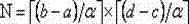
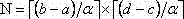
步骤6)子区域划分:考虑到室内复杂的传播特性,在整个的室内空间信号的空间分布可能是大不相同的,因此将室内区域划分成若干小区域,这样每个区域内的信号特征认为是相同的,以此来提高定位的准确性;具体的划分方式为,定位服务器根据数据库中的坐标信息设定一个表征子区域大小的


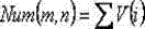
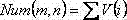
步骤7)目标节点投票选举阶段:佩戴在人身上的目标节点在工作状态下,每隔一定的时间间隔周期性的发送包含目标节点唯一标识的投票信号,位于天花板上的参考节点在一个给定的极短的统计周期T内,每收到一次来自目标节点的投票信号,其计数增1,在该阶段,参考节点仅仅接收信号,并不发送信号,以便节省能量; Step 7) The target node voting stage: the target node worn on the person is in the working state, periodically sends a voting signal containing the unique identification of the target node at regular intervals, and the reference node on the ceiling is in a given In the very short statistical period T, each time a voting signal from the target node is received, the count is increased by 1. In this stage, the reference node only receives the signal and does not send the signal to save energy;
步骤8)候选节点集的确定:统计周期结束后,基站获取参考节点的投票统计计数,那些投票数大于某个阙值


步骤9)基站向候选节点发送命令,候选节点收到命令后向目标节点发送射频信号,目标节点获取候选节点的标识

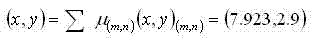
步骤10)定位服务器根据步骤9 )所得到的相关信息,从数据库中调取每个候选节点对应的坐标信息,对于位于某一个子区域
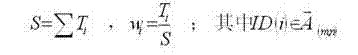
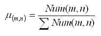
则目标节点坐落在该子区域的坐标分量为 Then the coordinate component of the target node located in this sub-area is
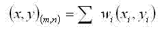
则取目标节点的坐标为: Then take the coordinates of the target node as:

其中 in
步骤11)定位服务器判断目标节点的坐标位置是否位于定位服务器的 Step 11) The positioning server judges the coordinate position of the target node is located on the location server's
危险区域中,如果是,则启动报警提醒; In the dangerous area, if it is, start the alarm reminder;
步骤12)考虑到室内信号传播受到室内环境信息的严重影响,采用监测器对室内的环境信息如温度,湿度以及光照,噪声等的信息进行实时的采集,监测器与定位服务器相连,如果定位发现环境信息明显发生变化便需要转步骤4)对整个定位系统进行数据的更新;否则转步骤7)继续进行跟踪; Step 12) Considering that indoor signal transmission is seriously affected by indoor environmental information, monitors are used to collect indoor environmental information such as temperature, humidity, light, and noise in real time. The monitors are connected to the positioning server. If the positioning finds If the environmental information changes obviously, it is necessary to go to step 4) to update the data of the entire positioning system; otherwise, go to step 7) to continue tracking;
步骤13)系统休眠:根据步骤8 )如果候选节点集为空,则基站发送休眠信号给系统,使系统处于休眠状态。 Step 13) System sleep: According to step 8) if the candidate node set is empty, the base station sends a sleep signal to the system to make the system sleep.
有益效果:本发明提出了一种基于无线传感器网络定位的人员智能看护方法,该方法具有如下优点: Beneficial effects: the present invention proposes a method for intelligent nursing care based on wireless sensor network positioning, which has the following advantages:
(1)该方法采用了无线传感器网络,该网络易于部署,节点价格低廉,采用无线通信的方式,避免了布线的麻烦。 (1) This method uses a wireless sensor network, which is easy to deploy, and the nodes are cheap. It uses wireless communication to avoid the trouble of wiring.
(2)该方法针对不同的节点以及环境,采用不同的坐标获取方式。符合实际情况的同时简单易行,便于迅速获得目标节点的位置,进行定位。 (2) This method adopts different coordinate acquisition methods for different nodes and environments. It is simple and easy to implement while conforming to the actual situation, and it is convenient to quickly obtain the position of the target node for positioning.
(3)考虑到室内定位受室内环境影响严重,在该方法中我们采用子区域的划分,投票以及监测器等手段尽量提高定位的精度。 (3) Considering that indoor positioning is seriously affected by the indoor environment, in this method we use sub-area division, voting and monitors to improve the positioning accuracy as much as possible.
(4)通过给基站加入WiFi模块,实现了无线传感器网络与现有以太网的结合,可以将信息及时的传送到定位服务器中,由定位服务器完成大量数据的处理,不仅增强了网络的功能还减少了节点的能耗。 (4) By adding a WiFi module to the base station, the combination of the wireless sensor network and the existing Ethernet is realized, and the information can be transmitted to the positioning server in time, and the positioning server completes the processing of a large amount of data, which not only enhances the function of the network but also Reduced energy consumption of nodes.
(5)该方法协助家人看护需要被看护的人员,减少了安全隐患带来的问题, (5) This method assists the family to take care of the people who need to be cared for, reducing the problems caused by potential safety hazards,
同时会减轻家人的负担以及由于疏忽带来的安全问题。 At the same time, it will reduce the burden on the family and the safety problems caused by negligence.
附图说明 Description of drawings
图1 是基站的组成结构图。 Figure 1 is a structural diagram of the base station.
图2 基于无线传感器网络定位的人员智能看护系统结构图。 Figure 2. The structure diagram of the personnel intelligent nursing system based on wireless sensor network positioning. the
图3 子区域的划分示意图。 Figure 3 Schematic diagram of the division of sub-regions.
图4 基于无线传感器网络定位的人员智能看护方法工作流程图。 Fig. 4 Workflow diagram of the intelligent nursing method for personnel based on wireless sensor network positioning.
具体实施方式 Detailed ways
本发明的基于无线传感器网络定位的人员智能看护方法具体流程如下: The specific flow of the personnel intelligent nursing method based on wireless sensor network positioning of the present invention is as follows:
步骤1)设计基于无线传感器网络定位的人员智能看护系统,如图2所示, Step 1) Design a personnel intelligent care system based on wireless sensor network positioning, as shown in Figure 2,
该系统主要包括各类无线传感器节点(信标节点、盲节点、目标节点),数据库,环境监测器以及定位服务器。 The system mainly includes various wireless sensor nodes (beacon nodes, blind nodes, target nodes), databases, environmental monitors and positioning servers.
步骤2)首先在天花板平面上建立合适的平面坐标系(在家庭室内定位方法中,危险区域通过平面坐标系即可很好的表征)并将室内存在安全隐患的危险区域的坐标信息通过定位服务器录入到数据库中。 Step 2) First establish a suitable plane coordinate system on the ceiling plane (in the home indoor positioning method, the dangerous area can be well represented by the plane coordinate system) and pass the coordinate information of the indoor dangerous area with potential safety hazards through the positioning server entered into the database.
步骤3)参考节点的安装与配置:初始时,给参考节点分配相应的标识信息


步骤4)参考节点地理位置的数字化过程:由于参考节点中的信标节点的坐标位置是已知的,该过程仅需要获得盲节点的坐标位置,为后续的目标节点的定位做准备。考虑到信号在天花板平面传播时较少的受到障碍物的影响,在数字化过程中,使用了一种简单可行的方法,具体为,盲节点广播一个请求获得自身位置的hello广播包,收该广播包的信标节点将自己的位置坐标信息写入响应包中返回给相应的盲节点,盲节点将接收到的坐标信息进行算术平均的结果作为自己的位置坐标,已经获得位置坐标的盲节点标记自己为新的信标节点。如此下去,直至所有的盲节点都变为新的信标节点,这样数字化过程结束。 Step 4) Digitization of the geographic location of the reference node: Since the coordinates of the beacon nodes in the reference node are known, this process only needs to obtain the coordinates of the blind node to prepare for the subsequent positioning of the target node. Considering that the signal is less affected by obstacles when it propagates on the ceiling plane, a simple and feasible method is used in the digitization process. Specifically, the blind node broadcasts a hello broadcast packet requesting its own location, and receives the broadcast The beacon node of the packet writes its location coordinate information into the response packet and returns it to the corresponding blind node. The blind node takes the arithmetic mean result of the received coordinate information as its own location coordinate, and the blind node mark that has obtained the location coordinate I am the new beacon node. This continues until all blind nodes become new beacon nodes, and the digitization process ends.
步骤5)依赖于步骤4 ),信标节点将自己的坐标位置信息发送给基站,基站通 Step 5) depends on step 4), the beacon node sends its own coordinate position information to the base station, and the base station communicates
过其WiFi模块将坐标信息给无线接入点AP(Access Point),接入点AP通过与现有的以太网相连,将信息传送到数据库中。 Through its WiFi module, the coordinate information is sent to the wireless access point AP (Access Point), and the access point AP is connected to the existing Ethernet to transmit the information to the database.
步骤6)子区域划分:考虑到室内复杂的传播特性,在整个的室内空间信号的空间分布可能是大不相同的,因此将室内区域划分成若干小区域,这样每个区域内的信号特征可认为是相同的,以此来提高定位的准确性。具体的划分方式为,定位服务器根据数据库中的坐标信息设定一个表征子区域大小的


步骤7)目标节点投票选举阶段:佩戴在人身上的目标节点在工作状态下,每隔一定的时间间隔周期性的发送包含目标节点唯一标识的投票信号。位于天花板上的参考节点在一个给定的极短的统计周期T内,每收到一次来自目标节点的投票信号,其计数增1,在该阶段,参考节点仅仅接收信号,并不发送信号,以便节省能量。 Step 7) Target node voting stage: The target node worn on the person is in the working state, and periodically sends a voting signal containing the unique identification of the target node at regular intervals. The reference node on the ceiling will increase its count by 1 every time it receives a voting signal from the target node within a given very short statistical period T. At this stage, the reference node only receives signals and does not send signals. in order to save energy.
步骤8)候选节点集的确定:统计周期结束后,基站获取参考节点的投票统计计数,那些投票数大于某个阙值


步骤9)基站向候选节点发送命令,候选节点收到命令后向目标节点发送射频信号,目标节点获取候选节点的标识

步骤10)定位服务器根据步骤9 )所得到的相关信息,从数据库中调取每个 Step 10) The positioning server retrieves each
候选节点对应的坐标信息,对于位于某一个子区域
则目标节点坐落在该子区域的坐标分量为 Then the coordinate component of the target node located in this sub-area is

则取目标节点的坐标为: Then take the coordinates of the target node as:
其中 in

步骤11)定位服务器判断目标节点的坐标位置
步骤12)考虑到室内信号传播受到室内环境信息的严重影响,采用监测器对室内的环境信息如温度,湿度以及光照,噪声等的信息进行实时的采集,监测器与定位服务器相连,如果定位发现环境信息明显发生变化便需要转步骤4)对整个定位系统进行数据的更新;否则转步骤7)继续进行跟踪。 Step 12) Considering that indoor signal transmission is seriously affected by indoor environmental information, monitors are used to collect indoor environmental information such as temperature, humidity, light, and noise in real time. The monitors are connected to the positioning server. If the positioning finds If the environmental information changes obviously, it is necessary to go to step 4) to update the data of the entire positioning system; otherwise, go to step 7) to continue tracking.
步骤13)系统休眠:根据步骤8 )如果候选节点集为空,则基站发送休眠信号给系统,使系统处于休眠状态,上述定位过程如图4所示。 Step 13) System dormancy: According to step 8) if the candidate node set is empty, the base station sends a dormancy signal to the system to make the system in a dormant state. The above positioning process is shown in Figure 4.
实例: Example:
本发明采用无线传感器网络中的的定位技术实现家庭中弱势群体的智能看护。以A家庭为例,该家庭共有3位成员,爸爸,妈妈和小明,小明只有3岁,活泼好动,无安全意识;家里对小明可能有安全隐患的地方有厨房,电源等。具体的实施步骤如下: The invention adopts the positioning technology in the wireless sensor network to realize the intelligent care of the disadvantaged groups in the family. Take family A as an example. There are 3 members in this family, father, mother and Xiao Ming. Xiao Ming is only 3 years old, lively and active, and has no safety awareness. The places in the home that may pose safety hazards to Xiao Ming include the kitchen, power supply, etc. The specific implementation steps are as follows:
步骤1)根据图2所示构建基于无线传感器网络定位的人员智能看护系统,该系统包括参考节点(盲节点,信标节点),目标节点,数据库,环境监测器,定位服务器以及已有的以太网。 Step 1) Construct an intelligent personnel care system based on wireless sensor network positioning as shown in Figure 2. The system includes reference nodes (blind nodes, beacon nodes), target nodes, databases, environmental monitors, positioning servers and existing Ethernet net.
步骤2)根据所建立的平面坐标系,父母预先将厨房,电源等的危险区域范围的坐标信息通过定位服务器录入到数据库中。 Step 2) According to the established plane coordinate system, the parents pre-enter the coordinate information of the dangerous area range of the kitchen, power supply, etc. into the database through the positioning server.
步骤3)参考节点的安装与配置:初始时,给参考节点分配相应的ID编号()以及节点类型标识码Type(0标识盲节点,1标识信标节点),然后可通过人工的方式将参考节点中的信标节点和盲节点合理搭配均匀的部署在室内的天花板上。 Step 3) Installation and configuration of the reference node: Initially, assign the corresponding ID number to the reference node ( ) and the node type identification code Type (0 identifies a blind node, 1 identifies a beacon node), and then the beacon nodes and blind nodes in the reference node can be reasonably matched and evenly deployed on the indoor ceiling by manual means.
步骤4)参考节点地理位置的数字化过程:参考节点中的信标节点的坐标位置是已知的,该过程是为了获得盲节点的坐标位置,为后续的目标节点的定位做准备。具体过程为,比如盲节点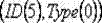


步骤5)依赖于步骤4),所有的信标节点将自己的坐标位置信息发送给基站,基站通过其WiFi模块将坐标信息给无线接入点AP(Access Point),接入点AP通过与现有的以太网相连,将信息传送到数据库中。 Step 5) Depending on step 4), all beacon nodes send their own coordinate position information to the base station, and the base station sends the coordinate information to the wireless access point AP (Access Point) through its WiFi module, and the access point AP communicates with the current Some are connected via Ethernet to transmit the information to the database.
步骤6)子区域划分:假设定位服务器根据数据库中的坐标信息设定


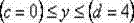


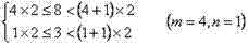
则该节点便被划分到子区域 中,如图3。数据库存储它们的划分结果。 Then the node is divided into sub-regions , as shown in Figure 3. The database stores their division results.
步骤7)佩戴在小明身上的目标节点每隔一定的时间间隔周期性的发送包含目标节点唯一的标识
步骤8)候选节点集的确定:在一个统计周期结束后,假设基站获取的候选节点集不为空,候选节点集合为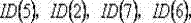


步骤9)基站向候选节点发送命令,候选节点收到命令后向目标节点发送射频信号,目标节点获取候选节点的标识

步骤10)定位服务器根据步骤9)所得相关信息,从数据库中调取每个候选节点对应的坐标信息,对于位于子区域


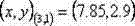
得目标节点位于子区域


步骤11)定位服务器判断目标节点的坐标位置
步骤12)监测器对室内的环境信息如温度,湿度以及光照,噪声等的信息进行实时的采集,并与定位服务器相连,如果定位服务器发现环境信息明显发生变 Step 12) The monitor collects indoor environmental information such as temperature, humidity, light, noise, etc. in real time, and connects to the positioning server. If the positioning server finds that the environmental information has changed significantly
化便需要转步骤4)对整个定位系统进行数据的更新;否则转步骤7)继续进行跟 It is necessary to go to step 4) to update the data of the entire positioning system; otherwise, go to step 7) to continue tracking
踪。 trace.
步骤13)系统休眠:根据步骤8 )如果候选节点集为空,则基站发送休眠信号给系统,使系统处于休眠状态,上述定位过程如图4所示。 Step 13) System dormancy: According to step 8) if the candidate node set is empty, the base station sends a dormancy signal to the system to make the system in a dormant state. The above positioning process is shown in Figure 4.
Claims (1)


Priority Applications (1)
| Application Number | Priority Date | Filing Date | Title |
|---|---|---|---|
| CN2012100835168A CN102682572B (en) | 2012-03-27 | 2012-03-27 | An intelligent nursing method for personnel based on wireless sensor network positioning |
Applications Claiming Priority (1)
| Application Number | Priority Date | Filing Date | Title |
|---|---|---|---|
| CN2012100835168A CN102682572B (en) | 2012-03-27 | 2012-03-27 | An intelligent nursing method for personnel based on wireless sensor network positioning |
Publications (2)
| Publication Number | Publication Date |
|---|---|
| CN102682572A true CN102682572A (en) | 2012-09-19 |
| CN102682572B CN102682572B (en) | 2013-11-27 |
Family
ID=46814419
Family Applications (1)
| Application Number | Title | Priority Date | Filing Date |
|---|---|---|---|
| CN2012100835168A Active CN102682572B (en) | 2012-03-27 | 2012-03-27 | An intelligent nursing method for personnel based on wireless sensor network positioning |
Country Status (1)
| Country | Link |
|---|---|
| CN (1) | CN102682572B (en) |
Cited By (13)
| Publication number | Priority date | Publication date | Assignee | Title |
|---|---|---|---|---|
| CN102984822A (en) * | 2012-12-12 | 2013-03-20 | 北京凯思昊鹏软件工程技术有限公司 | Perception method for personnel activities in limited space |
| CN103592624A (en) * | 2013-11-22 | 2014-02-19 | 中国人民解放军理工大学 | Distance measuring method based on strength of received signal |
| CN103974414A (en) * | 2014-05-16 | 2014-08-06 | 中国舰船研究设计中心 | Indoor positioning method based on simplified point distribution |
| CN104168540A (en) * | 2014-08-07 | 2014-11-26 | 南京邮电大学 | Data transmission method for IPV6 delay-tolerant sensing network on basis of location privacy |
| CN105072391A (en) * | 2015-07-30 | 2015-11-18 | 广东欧珀移动通信有限公司 | A method and device for monitoring indoor child safety |
| WO2016155496A1 (en) * | 2015-04-02 | 2016-10-06 | 阿里巴巴集团控股有限公司 | Time-based node election method and apparatus |
| WO2016192162A1 (en) * | 2015-05-29 | 2016-12-08 | 宇龙计算机通信科技(深圳)有限公司 | Smart nursing reminder method, nursing end device, and smart nursing system |
| CN106851858A (en) * | 2017-03-15 | 2017-06-13 | 广东工业大学 | A kind of wireless sensor system and wireless sensing method based on WIFI |
| CN108474859A (en) * | 2017-08-15 | 2018-08-31 | 深圳市大疆创新科技有限公司 | Positioning system and its construction method |
| CN109147275A (en) * | 2018-10-12 | 2019-01-04 | 盈奇科技(深圳)有限公司 | A kind of preschoolers ' families protection system based on gravitational track |
| CN111829579A (en) * | 2020-06-02 | 2020-10-27 | 深圳全景空间工业有限公司 | A method of interior space reconstruction |
| US10849205B2 (en) | 2015-10-14 | 2020-11-24 | Current Lighting Solutions, Llc | Luminaire having a beacon and a directional antenna |
| CN114061669A (en) * | 2021-11-25 | 2022-02-18 | 广东潜力会科技发展有限公司 | Intelligent monitoring system of environmental protection equipment |
Citations (5)
| Publication number | Priority date | Publication date | Assignee | Title |
|---|---|---|---|---|
| KR20090040693A (en) * | 2007-10-22 | 2009-04-27 | 주식회사 옥타컴 | Elderly elderly abnormal condition monitoring equipment |
| CN101459870A (en) * | 2008-03-05 | 2009-06-17 | 中科院嘉兴中心微系统所分中心 | Indoor positioning system based on wireless sensor network and implementing method |
| CN101545964A (en) * | 2008-03-28 | 2009-09-30 | 中国人民解放军信息工程大学 | One-dimensional positioning method and device based on wireless sensor network |
| CN101547048A (en) * | 2008-03-05 | 2009-09-30 | 中科院嘉兴中心微系统所分中心 | Indoor positioning method based on wireless sensor network |
| CN102359787A (en) * | 2011-07-15 | 2012-02-22 | 东南大学 | WSN/MINS high-precision and real-time combination navigation information fusion method |
-
2012
- 2012-03-27 CN CN2012100835168A patent/CN102682572B/en active Active
Patent Citations (5)
| Publication number | Priority date | Publication date | Assignee | Title |
|---|---|---|---|---|
| KR20090040693A (en) * | 2007-10-22 | 2009-04-27 | 주식회사 옥타컴 | Elderly elderly abnormal condition monitoring equipment |
| CN101459870A (en) * | 2008-03-05 | 2009-06-17 | 中科院嘉兴中心微系统所分中心 | Indoor positioning system based on wireless sensor network and implementing method |
| CN101547048A (en) * | 2008-03-05 | 2009-09-30 | 中科院嘉兴中心微系统所分中心 | Indoor positioning method based on wireless sensor network |
| CN101545964A (en) * | 2008-03-28 | 2009-09-30 | 中国人民解放军信息工程大学 | One-dimensional positioning method and device based on wireless sensor network |
| CN102359787A (en) * | 2011-07-15 | 2012-02-22 | 东南大学 | WSN/MINS high-precision and real-time combination navigation information fusion method |
Cited By (23)
| Publication number | Priority date | Publication date | Assignee | Title |
|---|---|---|---|---|
| CN102984822A (en) * | 2012-12-12 | 2013-03-20 | 北京凯思昊鹏软件工程技术有限公司 | Perception method for personnel activities in limited space |
| CN103592624A (en) * | 2013-11-22 | 2014-02-19 | 中国人民解放军理工大学 | Distance measuring method based on strength of received signal |
| CN103974414A (en) * | 2014-05-16 | 2014-08-06 | 中国舰船研究设计中心 | Indoor positioning method based on simplified point distribution |
| CN103974414B (en) * | 2014-05-16 | 2017-10-24 | 中国舰船研究设计中心 | Based on the simplified indoor orientation method layouted |
| CN104168540B (en) * | 2014-08-07 | 2017-07-11 | 南京邮电大学 | The data transmission method of the IPV6 delay-tolerant Sensor Networks based on location privacy |
| CN104168540A (en) * | 2014-08-07 | 2014-11-26 | 南京邮电大学 | Data transmission method for IPV6 delay-tolerant sensing network on basis of location privacy |
| WO2016155496A1 (en) * | 2015-04-02 | 2016-10-06 | 阿里巴巴集团控股有限公司 | Time-based node election method and apparatus |
| US10534634B2 (en) | 2015-04-02 | 2020-01-14 | Alibaba Group Holding Limited | Efficient, time-based leader node election in a distributed computing system |
| US11106489B2 (en) | 2015-04-02 | 2021-08-31 | Ant Financial (Hang Zhou) Network Technology Co., Ltd. | Efficient, time-based leader node election in a distributed computing system |
| CN106155780A (en) * | 2015-04-02 | 2016-11-23 | 阿里巴巴集团控股有限公司 | A kind of time-based node electoral machinery and device |
| US10802869B2 (en) | 2015-04-02 | 2020-10-13 | Alibaba Group Holding Limited | Efficient, time-based leader node election in a distributed computing system |
| CN106155780B (en) * | 2015-04-02 | 2020-01-31 | 阿里巴巴集团控股有限公司 | node election method and device based on time |
| WO2016192162A1 (en) * | 2015-05-29 | 2016-12-08 | 宇龙计算机通信科技(深圳)有限公司 | Smart nursing reminder method, nursing end device, and smart nursing system |
| CN105072391A (en) * | 2015-07-30 | 2015-11-18 | 广东欧珀移动通信有限公司 | A method and device for monitoring indoor child safety |
| US10849205B2 (en) | 2015-10-14 | 2020-11-24 | Current Lighting Solutions, Llc | Luminaire having a beacon and a directional antenna |
| CN106851858A (en) * | 2017-03-15 | 2017-06-13 | 广东工业大学 | A kind of wireless sensor system and wireless sensing method based on WIFI |
| CN108474859B (en) * | 2017-08-15 | 2019-08-13 | 深圳市大疆创新科技有限公司 | Positioning system and its construction method |
| WO2019033282A1 (en) * | 2017-08-15 | 2019-02-21 | 深圳市大疆创新科技有限公司 | Positioning system and building method therefor |
| CN108474859A (en) * | 2017-08-15 | 2018-08-31 | 深圳市大疆创新科技有限公司 | Positioning system and its construction method |
| CN109147275A (en) * | 2018-10-12 | 2019-01-04 | 盈奇科技(深圳)有限公司 | A kind of preschoolers ' families protection system based on gravitational track |
| CN111829579A (en) * | 2020-06-02 | 2020-10-27 | 深圳全景空间工业有限公司 | A method of interior space reconstruction |
| CN114061669A (en) * | 2021-11-25 | 2022-02-18 | 广东潜力会科技发展有限公司 | Intelligent monitoring system of environmental protection equipment |
| CN114061669B (en) * | 2021-11-25 | 2022-11-08 | 广东潜力会科技发展有限公司 | Intelligent monitoring system of environmental protection equipment |
Also Published As
| Publication number | Publication date |
|---|---|
| CN102682572B (en) | 2013-11-27 |
Similar Documents
| Publication | Publication Date | Title |
|---|---|---|
| CN102682572A (en) | Wireless sensor network positioning-based intelligent person nursing method | |
| CN101945472B (en) | Method for positioning multiple moving targets by wireless sensor network syncretized with radio frequency identification | |
| CN106796748A (en) | Self-learning system for identifying status and location of pets | |
| US10805767B2 (en) | Method for tracking the location of a resident within a facility | |
| JP2015505406A (en) | Emergency response and tracking using lighting networks | |
| CN107071899A (en) | Real-time positioning system in a kind of quick high accuracy room | |
| TWI593988B (en) | Indoor positioning system and method | |
| CN109525937B (en) | Positioning method of indoor positioning management system integrating multiple positioning modes | |
| CN106597360A (en) | Method for using robot to real-time and dynamically position and monitor indoor object based on RFID | |
| CN105137956B (en) | A kind of three-dimensional position induction system and method | |
| CN104361371A (en) | Positioning system and method based on RIFD technology | |
| CN101754247A (en) | A Mine Positioning System and Its Positioning Method Based on Multiple Linear Regression | |
| CN104181615B (en) | A kind of microclimate environment and physical message monitor general-purpose platform in real time | |
| CN107064872A (en) | A kind of passive type indoor orientation method and system based on intensity variation | |
| CN103605109B (en) | Mine underground accurate positioning system and positioning method based on linear frequency modulation signals | |
| CN204143471U (en) | Based on the positioning system of RFID technique | |
| CN105588606A (en) | Plant environmental monitoring system | |
| CN207010998U (en) | A fast and high-precision indoor real-time positioning device | |
| CN203276349U (en) | An apparatus for intelligently inquiring the number of people in a classroom | |
| CN116866834A (en) | Positioning method, device and storage medium | |
| CN206789018U (en) | A kind of family endowment system based on ZigBee indoor positioning technologies | |
| CN204115738U (en) | Based on the large-scale indoor locating system of infrared coordinate code | |
| CN102387467A (en) | Personal belongings management system based on ZigBee protocol | |
| CN202406294U (en) | Personal article management system based on ZigBee protocol | |
| CN206075511U (en) | A kind of home environment monitoring system based on Zigbee |
Legal Events
| Date | Code | Title | Description |
|---|---|---|---|
| C06 | Publication | ||
| PB01 | Publication | ||
| C10 | Entry into substantive examination | ||
| SE01 | Entry into force of request for substantive examination | ||
| C14 | Grant of patent or utility model | ||
| GR01 | Patent grant | ||
| TR01 | Transfer of patent right | ||
| TR01 | Transfer of patent right |
Effective date of registration: 20210508 Address after: 210046 No. 9 Wenyuan Road, Qixia District, Nanjing, Jiangsu Province Patentee after: NANJING University OF POSTS AND TELECOMMUNICATIONS Patentee after: JIANGSU INTELLITRAINS Co.,Ltd. Address before: 210046 No. 9 Wenyuan Road, Qixia District, Nanjing, Jiangsu Province Patentee before: NANJING University OF POSTS AND TELECOMMUNICATIONS Patentee before: NANJING SAMPLE TECHNOLOGY Co.,Ltd. |