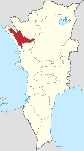
Malabon
Appearance
| Malabon | ||
|---|---|---|
| Marakel ya siyudad | ||
 | ||
| ||
 Lokasyon na Malabon | ||
 | ||
| 14°39′36″N 120°57′36″E | ||
| Dalin | Filipinas | |
| Angipaletnegan | Abril 21, 2001 | |
| Barangay | 21 | |
| Gobiyerno | ||
| • Alkalde | Jeannie Sandoval | |
| Kaawang | ||
| • Katiponan | 15.71 km2 (6.07 sq mi) | |
| Elebasyon | 23 m (75 ft) | |
| Bilang na too (Mayo 1, 2020)[1] | ||
| • Katiponan | 380,522 | |
| • Densidad | 24,000/km2 (63,000/sq mi) | |
| Economia | ||
| • Clase | unaan ya klase a siyudad | |
| • Ingresos | ₱2,055,959,150.00 (2020) | |
| • Activos | ₱4,064,188,007.00 (2020) | |
| • Pasivos | ₱1,362,556,487.00 (2020) | |
| • Gastos | ₱1,860,022,325.00 (2020) | |
| Kodigo na lugar | 02 | |
| Website |
malabon | |
Say Malabon et unaan ya klase a siyudad ed luyag na Metro Manila, Filipinas. Unong ed 1 Mayo 2020 census, say populasyon to et 380,522 totoo tan 94,241 abong. Walay kabaleg tan sukat to ya 15.71 sq. km. Say zip code to et .
Saray barangay
[dumaen | dumaen so pinanlapuan]- Acacia
- Baritan
- Bayan-bayanan
- Catmon
- Concepcion
- Dampalit
- Flores
- Hulong Duhat
- Ibaba
- Longos
- Maysilo
- Muzon
- Niugan
- Panghulo
- Potrero
- San Agustin
- Santolan
- Tañong (Pob.)
- Tinajeros
- Tonsuya
- Tugatog
Demograpiko
[dumaen | dumaen so pinanlapuan]| Taon | Pop. | ±% p.a. |
|---|---|---|
| 1903 | 20,136 | — |
| 1918 | 21,695 | +0.50% |
| 1939 | 33,285 | +2.06% |
| 1948 | 46,455 | +3.77% |
| 1960 | 76,438 | +4.24% |
| 1970 | 141,514 | +6.35% |
| 1975 | 174,878 | +4.34% |
| 1980 | 191,001 | +1.78% |
| 1990 | 280,027 | +3.90% |
| 1995 | 347,484 | +4.13% |
| 2000 | 338,855 | −0.54% |
| 2007 | 363,681 | +0.98% |
| 2010 | 353,337 | −1.04% |
| 2015 | 365,525 | +0.65% |
| 2020 | 380,522 | +0.79% |
| Reperensiya: Philippine Statistics Authority[2][3][4] | ||
Saray imahe
[dumaen | dumaen so pinanlapuan]-
Say Iglesia na San Bartolome
-
Say Iglesia na San Bartolome
Saray reperensiya
[dumaen | dumaen so pinanlapuan]- ↑ "2020 Census of Population and Housing (2020 CPH) Population Counts Declared Official by the President". Hulyo 7, 2021. https://psa.gov.ph/content/2020-census-population-and-housing-2020-cph-population-counts-declared-official-president.
- ↑ Census of Population (2015). "National Capital Region (NCR)". Total Population by Province, City, Municipality and Barangay. PSA. Retrieved 29 June 2016.
- ↑ Census of Population and Housing (2010). "National Capital Region (NCR)". Total Population by Province, City, Municipality and Barangay. NSO. Retrieved 29 June 2016.
- ↑ Censuses of Population (1903–2007). "National Capital Region (NCR)". Table 1. Population Enumerated in Various Censuses by Province/Highly Urbanized City: 1903 to 2007. NSO.


