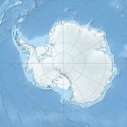
Heald Island
Utsjånad
| Heald Island - Antarctic.jpg | |||
| øy | |||
| Land | |||
|---|---|---|---|
| Høgd | 555 moh. | ||
| Koordinatar | 78°15′S 163°49′E / 78.250°S 163.817°E | ||
| Lengd | 5 km | ||
| Administrert under | Antarktistraktaten | ||
 Heald Island 78°15′00″S 163°49′00″E / 78.25°S 163.81666666667°E | |||
Heald Island er ei øy som stig opp av isen på Koettlitzbreen like aust for Walcott Bay i Victoria Land i Antarktis. Ho vart oppdaga og namngjeven av Discovery-ekspedisjonen (1901–04) etter matrosen William L. Heald, eit ekspedisjonsmedlem som redda livet til Hartley T. Ferrar då sistnemnde leid av skjørbuk i 1902.[1]
Sjå òg
[endre | endre wikiteksten]Kjelder
[endre | endre wikiteksten]- ↑ «Heald Island». Geographic Names Information System. United States Geological Survey, United States Department of the Interior. Henta 19. oktober 2012.
![]() Denne artikkelen inneheld stoff som er offentleg eige frå United States Geological Survey-artikkelen «Heald Island» (innhald frå Geographic Names Information System).
Denne artikkelen inneheld stoff som er offentleg eige frå United States Geological Survey-artikkelen «Heald Island» (innhald frå Geographic Names Information System).
