Garrett County
Uiterlijk
| County in de Verenigde Staten | |||
|---|---|---|---|

| |||
| Situering | |||
| Staat | Maryland | ||
| Coördinaten | 39°17'NB, 79°22'WL | ||
| Algemeen | |||
| Oppervlakte | 1.699 km² | ||
| - land | 1.678 km² | ||
| - water | 21 km² | ||
| Inwoners (2000) |
29.846 (18 inw./km²) | ||
| Overig | |||
| Zetel | Oakland | ||
| FIPS-code | 24023 | ||
| Opgericht | 1872 | ||
| Website | www | ||
| Detailkaart | |||

| |||
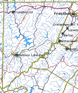
| Overzichtskaart van Garrett County | |||
| Foto's | |||
 Bevolkingspiramide Garrett County | |||
| Statistieken volkstelling Garrett County | |||
| |||
Garrett County is de meest westelijke county van de Amerikaanse staat Maryland, vernoemd naar John W. Garrett, directeur van de Baltimore and Ohio Railroad.
De county heeft een landoppervlakte van 1.678 km² en telt 29.846 inwoners (volkstelling 2000). De hoofdplaats is Oakland.
Bevolkingsontwikkeling
[bewerken | brontekst bewerken]| Jaar | Inwoners | % ± | |
|---|---|---|---|
| 1900 | 17.701 | — | |
| 1910 | 20.105 | 13,6% | |
| 1920 | 19.678 | −2,1% | |
| 1930 | 19.908 | 1,2% | |
| 1940 | 21.981 | 10,4% | |
| 1950 | 21.259 | −3,3% | |
| 1960 | 20.420 | −3,9% | |
| 1970 | 21.476 | 5,2% | |
| 1980 | 26.498 | 23,4% | |
| 1990 | 28.138 | 6,2% | |
| 2000 | 29.846 | 6,1% | |
| Bron: (en) Historical Decennial Census Population | |||