


Python codes for robotics algorithm.
- What is this?
- Requirements
- Documentation
- How to use
- Localization
- Mapping
- SLAM
- Path Planning
- Path Tracking
- Arm Navigation
- Aerial Navigation
- Bipedal
- License
- Use-case
- Contribution
- Citing
- Support
- Sponsors
- Authors
This is a Python code collection of robotics algorithms.
Features:
-
Easy to read for understanding each algorithm's basic idea.
-
Widely used and practical algorithms are selected.
-
Minimum dependency.
See this paper for more details:
For running each sample code:
For development:
-
pytest (for unit tests)
-
pytest-xdist (for parallel unit tests)
-
mypy (for type check)
-
sphinx (for document generation)
-
pycodestyle (for code style check)
This README only shows some examples of this project.
If you are interested in other examples or mathematical backgrounds of each algorithm,
You can check the full documentation online: https://pythonrobotics.readthedocs.io/
All animation gifs are stored here: AtsushiSakai/PythonRoboticsGifs: Animation gifs of PythonRobotics
- Clone this repo.
git clone https://github.com/AtsushiSakai/PythonRobotics.git
- Install the required libraries.
using conda :
conda env create -f requirements/environment.yml
using pip :
pip install -r requirements/requirements.txt
-
Execute python script in each directory.
-
Add star to this repo if you like it 😃.

Documentation: Notebook

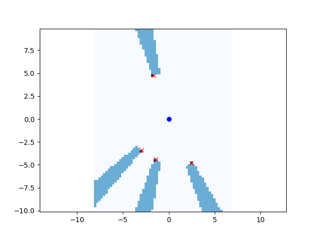
This is a sensor fusion localization with Particle Filter(PF).
The blue line is true trajectory, the black line is dead reckoning trajectory,
and the red line is an estimated trajectory with PF.
It is assumed that the robot can measure a distance from landmarks (RFID).
These measurements are used for PF localization.
Ref:

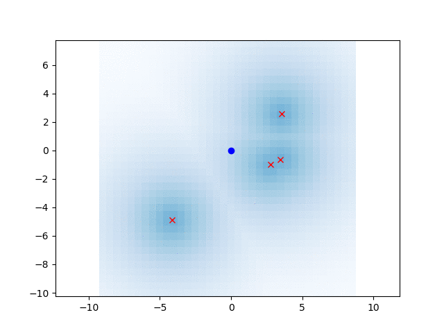
This is a 2D localization example with Histogram filter.
The red cross is true position, black points are RFID positions.
The blue grid shows a position probability of histogram filter.
In this simulation, x,y are unknown, yaw is known.
The filter integrates speed input and range observations from RFID for localization.
Initial position is not needed.
Ref:
This is a 2D Gaussian grid mapping example.
This is a 2D ray casting grid mapping example.
This example shows how to convert a 2D range measurement to a grid map.

This is a 2D object clustering with k-means algorithm.

This is a 2D rectangle fitting for vehicle detection.

Simultaneous Localization and Mapping(SLAM) examples
This is a 2D ICP matching example with singular value decomposition.
It can calculate a rotation matrix, and a translation vector between points and points.
Ref:
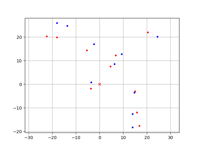
This is a feature based SLAM example using FastSLAM 1.0.
The blue line is ground truth, the black line is dead reckoning, the red line is the estimated trajectory with FastSLAM.
The red points are particles of FastSLAM.
Black points are landmarks, blue crosses are estimated landmark positions by FastSLAM.

Ref:
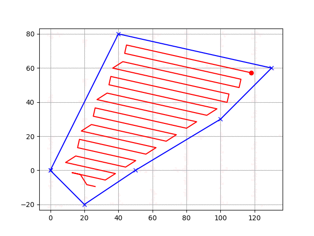
This is a 2D navigation sample code with Dynamic Window Approach.


