Yrke
Yrke
Yrkje | |
|---|---|
Village | |
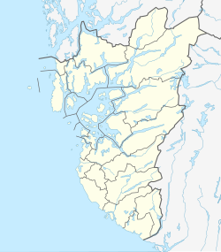
Location in Rogaland county | |
| Coordinates: 59°23′52″N 05°40′06″E / 59.39778°N 5.66833°E | |
| Country | Norway |
| Region | Western Norway |
| County | Rogaland |
| District | Haugaland |
| Municipality | Tysvær |
| Elevation | 41 m (135 ft) |
| Time zone | UTC+01:00 (CET) |
| • Summer (DST) | UTC+02:00 (CEST) |
| Post Code | 5567 Skjoldastraumen |
Yrke or Yrkje is a village in Tysvær municipality in Rogaland county, Norway. The village is located at the western end of the Yrkefjorden, a branch off of the main Vindafjorden. The village lies on a small isthmus between the Yrkefjorden and the Skjoldafjorden, along the County Road 515, the only road over the isthmus connecting the peninsula to the mainland.[2] The village of Skjoldastraumen lies about 5 kilometres (3.1 mi) to the northwest and the villages of Hindaråvåg and Nedstrand lie about 20 kilometres (12 mi) to the southeast.
History
[edit]The Yrke area was administratively part of the municipality of Skjold since 1838 when municipalities were created in Norway. On 1 January 1965, Skjold municipality was dissolved and its territory divided among three neighboring municipalities. The southwestern part of Skjold, which included the districts of Yrke, Dueland, and Grinde with a total of 1,133 inhabitants were merged into Tysvær municipality.[3]
References
[edit]- ^ "Yrke, Tysvær (Rogaland)" (in Norwegian). yr.no. Retrieved 2015-09-09.
- ^ Store norske leksikon. "Yrkjefjorden" (in Norwegian). Retrieved 2015-09-09.
- ^ Jukvam, Dag (1999). "Historisk oversikt over endringer i kommune- og fylkesinndelingen" (PDF) (in Norwegian). Statistisk sentralbyrå.

