Wigglesworth
Appearance
| Wigglesworth | |
|---|---|
| Village and civil parish | |
 Main street with public house to the left | |
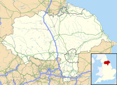
Location within North Yorkshire | |
| Population | 379 (Including Halton West. 2011 census)[1] |
| OS grid reference | SD809569 |
| Unitary authority | |
| Ceremonial county | |
| Region | |
| Country | England |
| Sovereign state | United Kingdom |
| Post town | Skipton |
| Postcode district | BD23 |
| Police | North Yorkshire |
| Fire | North Yorkshire |
| Ambulance | Yorkshire |
Wigglesworth is a village and civil parish in North Yorkshire, England. The population of the civil parish taken at the 2011 Census was 379.[1] It is on the road between Long Preston to the east and Slaidburn to the west. The small village of Rathmell lies 2 miles (3 km) to the north. It is about 5 miles (8 km) south of Settle.
Despite the small size of the village, it has a public house called the Plough Inn. Wigglesworth consists of a few small scattered houses and farmsteads.
A former Wesleyan chapel stands on the B6478 road in the western part of the settlement.[2]
References
[edit]- ^ a b UK Census (2011). "Local Area Report – Wigglesworth parish (1170216790)". Nomis. Office for National Statistics. Retrieved 12 April 2018.
- ^ Humphrey Bolton (9 August 2017). "The B6478 and the former Wesleyan chapel, Wigglesworth". Geograph Britain and Ireland.
External links
[edit]![]() Media related to Wigglesworth at Wikimedia Commons
Media related to Wigglesworth at Wikimedia Commons
