Ward River (Far North Queensland)
Appearance
| Ward | |
|---|---|
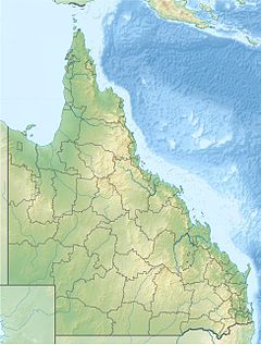
Location of Ward River mouth in Queensland | |
| Location | |
| Country | Australia |
| State | Queensland |
| Region | Far North Queensland |
| Physical characteristics | |
| Source | Cape York Peninsula |
| • elevation | 42 m (138 ft) |
| Mouth | Archer Bay |
• location | north of Aurukun |
• coordinates | 13°17′36″S 141°44′12″E / 13.29333°S 141.73667°E |
• elevation | 0 m (0 ft) |
| Length | 46 km (29 mi) |
| Basin features | |
| River system | Watson River catchment |
| [1] | |
The Ward River is a river in Far North Queensland, Australia.
The headwaters of the river rise on the Cape York Peninsula approximately 12 kilometres (7 mi) from the west coast and flows south through uninhabited country along the coastal plain and eventually discharges into Archer Bay, along with the Archer and Watson River,[2] just north of Aurukun[3] and then onto the Gulf of Carpentaria. Four tributaries contribute to the Ward; Coconut Creek, Tappelbang Creek, Sandy Creek and Possum Creek.[1]
The river is located within the Watson River catchment and in 2009 the river was considered for nomination as a wild river.[4]
See also
[edit]References
[edit]- ^ a b "Map of Ward River, QLD". Bonzle Digital Atlas of Australia. Retrieved 11 June 2015.
- ^ "Aurukun Cape York Mothership". Fishabout. Retrieved 11 June 2015.
- ^ "Aurukun campus". Queensland Government. 2015. Retrieved 11 June 2015.
- ^ "Stewart Basin wild river declaration consultation report". Queensland Government. 2009. Retrieved 11 June 2015.
