Veltrusy
Veltrusy | |
|---|---|
 A. Dvořáka Square with the Church of Saint John the Baptist | |
| Coordinates: 50°16′14″N 14°19′43″E / 50.27056°N 14.32861°E | |
| Country | |
| Region | Central Bohemian |
| District | Mělník |
| First mentioned | 1226 |
| Government | |
| • Mayor | Filip Volák |
| Area | |
• Total | 8.01 km2 (3.09 sq mi) |
| Elevation | 172 m (564 ft) |
| Population (2024-01-01)[1] | |
• Total | 2,297 |
| • Density | 290/km2 (740/sq mi) |
| Time zone | UTC+1 (CET) |
| • Summer (DST) | UTC+2 (CEST) |
| Postal code | 277 46 |
| Website | www |
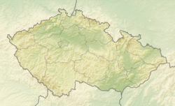
Veltrusy (Czech pronunciation: [ˈvɛltrusɪ]; German: Weltrus) is a town in Mělník District in the Central Bohemian Region of the Czech Republic. It has about 2,300 inhabitants. It is known for the Veltrusy Mansion.
Etymology
[edit]The name of the settlement arose from a derogatory designation of its inhabitants. The word veltrusi was used to refer to people who excreted a lot (in Czech velmi trousili).[2]
Geography
[edit]Veltrusy is located about 19 kilometres (12 mi) north of Prague. It lies in the Central Elbe Table. The highest point of the otherwise flat landscape is an artificially created rubble hill, Strachovská halda at 222 m (728 ft) above sea level. The town is situated on the right bank of the Vltava River.
History
[edit]The first trustworthy written mention of Veltrusy is in a deed of King Ottokar I from 1226, but according to some sources there are also older references. Until 1410, the village was owned by the church, then it was property of various noble families, including Zajíc of Hazmburk, Smiřický, Lobkowicz and Waldstein. From the 17th century until 1945, Veltrusy was owned by the Chotek family.[3]
Veltrusy was promoted to a market town in 1899 and to a town in 1926, but soon lost the title. In 1994, it was again promoted to a town.[3]
Demographics
[edit]
|
|
| ||||||||||||||||||||||||||||||||||||||||||||||||||||||
| Source: Censuses[4][5] | ||||||||||||||||||||||||||||||||||||||||||||||||||||||||
Transport
[edit]There are no railways or major roads running through the municipal territory. However, Veltrusy is located near the D8 motorway from Prague to Ústí nad Labem.
Sights
[edit]
The most important monument and tourist destination of the town is the Veltrusy Mansion. It is a Baroque castle with a large castle park and deer-park. The castle is open to the public and offers guided tours.[6]
The Church of Saint John the Baptist was built in the 14th century and rebuilt in the Baroque style in the 18th century. At the beginning of the 20th century, the Neoclassical tower was added. The interior is mostly in the Rococo style.[7] A distinctive element of the interior of the church is the cenotaph of Count Rudolf Chotek.[8]
References
[edit]- ^ "Population of Municipalities – 1 January 2024". Czech Statistical Office. 2024-05-17.
- ^ Profous, Antonín (1957). Místní jména v Čechách IV: S–Ž (in Czech). p. 498.
- ^ a b "Strategický plán města Veltrusy na období 2019–2029" (PDF) (in Czech). Město Veltrusy. 2019. p. 8. Retrieved 2023-02-07.
- ^ "Historický lexikon obcí České republiky 1869–2011" (in Czech). Czech Statistical Office. 2015-12-21.
- ^ "Population Census 2021: Population by sex". Public Database. Czech Statistical Office. 2021-03-27.
- ^ "Tours". Veltrusy Chateau (in Czech). National Heritage Institute. Retrieved 2023-02-07.
- ^ "Kostel Narození sv. Jana Křititele ve Veltrusech" (in Czech). CzechTourism. Retrieved 2023-02-07.
- ^ "Kostel Narození sv. Jana Křtitele" (in Czech). National Heritage Institute. Retrieved 2023-02-07.
External links
[edit]

