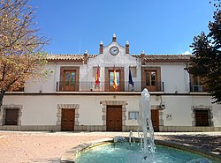
Urda, Toledo
Appearance
Urda | |
|---|---|
 | |
 | |
| Country | Spain |
| Autonomous community | Castile-La Mancha |
| Province | Toledo |
| Comarca | Montes de Toledo Comarca |
| Area | |
| • Total | 217 km2 (84 sq mi) |
| Elevation | 763 m (2,503 ft) |
| Population (2018)[1] | |
| • Total | 2,558 |
| • Density | 12/km2 (31/sq mi) |
| Time zone | UTC+1 (CET) |
| • Summer (DST) | UTC+2 (CEST) |
Urda is a municipality located in the province of Toledo, Castile-La Mancha, Spain.
According to the 2006 census (INE), the municipality had a population of 3164 inhabitants.
References
[edit]- ^ Municipal Register of Spain 2018. National Statistics Institute.
39°25′N 3°42′W / 39.417°N 3.700°W