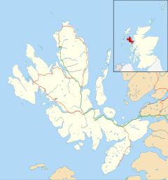
Tote, Skye
Appearance
Tote
| |
|---|---|
Location within the Isle of Skye | |
| OS grid reference | NG423489 |
| Council area | |
| Country | Scotland |
| Sovereign state | United Kingdom |
| Post town | Portree |
| Postcode district | IV51 9 |
| Police | Scotland |
| Fire | Scottish |
| Ambulance | Scottish |
Tote (Scottish Gaelic: Tobhta) is a small crofting township, situated on the southwest coast of the Trotternish peninsula, at the head of the sea loch, Loch Snizort Beag on the island of Skye[1] and is in the Scottish council area of Highland.
The village of Skeabost is located directly to the south, and Carbost is located directly southeast.

References
[edit]- ^ Microsoft; Nokia. "Tote, Skye" (Map). Bing Maps. Microsoft. Retrieved 17 February 2017.
Wikimedia Commons has media related to Tote, Isle of Skye.
