Tod River
Appearance
| Tod River | |
|---|---|
| Location | |
| Country | Australia |
| State | South Australia |
| Region | Eyre Peninsula |
| Physical characteristics | |
| Mouth | |
• location | Between Poonindie and North Shields |
• coordinates | 34°35′31″S 135°54′11″E / 34.592°S 135.903°E |
• elevation | 0 m |
| Length | 26 miles (42 km) |
| Discharge | |
| • location | Spencer Gulf |
| Basin features | |
| Waterbodies | Tod River Reservoir |
The Tod River is the only stream on Eyre Peninsula in South Australia with a reliable water flow. Its main tributary is Pillaworta Creek. The Tod River Reservoir was built across the river between 1918 and 1922.[1]
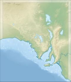
The Tod River flows southeast into the lower Spencer Gulf north of Port Lincoln. Its lower reach represents the boundary between Poonindie and North Shields.
The original Barngarla name for Tod River was Ngalda Warda.[2]: 79
The river was named on 20 May 1839 by a group exploring Spencer Gulf in the schooner Victoria after Robert Tod, one of the exploration party.[3] Victoria spent April and May 1839 surveying for land in the Spencer Gulf region.[4]
References
[edit]- ^ "Tod River Reservoir". SA Water. Retrieved 26 June 2019.
- ^ Zuckermann, Ghil'ad and the Barngarla (2019), Barngarlidhi Manoo (Speaking Barngarla Together), Barngarla Language Advisory Committee. (Barngarlidhi Manoo – Part II)
- ^ "Placename Details: Tod River". Property Location Browser Report. Government of South Australia. 15 September 2009. SA0008591. Retrieved 26 June 2019.
- ^ Cummings, Diane. "Victoria 1839". State Library of South Australia. Retrieved 26 June 2019.
