Sulham and Tidmarsh Woods and Meadows
| Site of Special Scientific Interest | |
 | |
| Location | Berkshire |
|---|---|
| Grid reference | SU 639 743[1] |
| Coordinates | 51°27′50″N 1°04′55″W / 51.464°N 1.082°W |
| Interest | Biological |
| Area | 75.7 hectares (187 acres)[1] |
| Notification | 1986[1] |
| Location map | Magic Map |
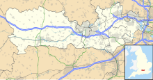
Sulham and Tidmarsh Woods and Meadows is a 75.7-hectare (187-acre) biological Site of Special Scientific Interest west of Reading in Berkshire.[1][2] Previously known as Pang Valley SSSI, the site is mostly sandwiched between the River Pang and the Sulham Road and includes Broom Copse, Herridge's Copse, Hogmoor Copse, Park Wood, Moor Copse and Barton's Copse. Much of the southern part of the site is the Berkshire, Buckinghamshire and Oxfordshire Wildlife Trust's Moor Copse Nature Reserve. The whole site lies within the North Wessex Downs Area of Outstanding Natural Beauty.[3][4]
The SSSI consists of five areas.
| Location | Unit area (Ha) | Main habitat |
|---|---|---|
| 51°28′13″N 1°04′58″W / 51.4704°N 1.0828°W | 15.24 | Acid grassland - lowland |
| 51°27′57″N 1°04′43″W / 51.4659°N 1.0786°W | 15.48 | Broadleaved, mixed and yew woodland - lowland |
| 51°27′38″N 1°05′04″W / 51.4605°N 1.0844°W | 27.57 | Broadleaved, mixed and yew woodland - lowland |
| 51°27′18″N 1°04′49″W / 51.4551°N 1.0803°W | 7.70 | Broadleaved, mixed and yew woodland - lowland |
| 51°27′57″N 1°04′59″W / 51.4659°N 1.0831°W | 9.76 | Neutral grassland - lowland |
The site is in a broad valley of unusually varied alluvial loams, gravel terraces and peat deposits, resulting from flooding in late glacial times by an enlarged River Kennet. The variety in soils and topography results in a mosaic of damp copses and seasonally flooded meadow communities, maintained here by a long history of coppicing and sympathetic grassland husbandry. The woodland on the site supports a rich invertebrate fauna including over 300 species of moth.[5]
References
[edit]- ^ a b c d "Designated Sites View: Sulham and Tidmarsh Woods and Meadows". Sites of Special Scientific Interest. Natural England. Retrieved 8 November 2019.
- ^ "Map of Sulham and Tidmarsh Woods and Meadows". Sites of Special Scientific Interest. Natural England. Retrieved 8 November 2019.
- ^ "Sulham and Tidmarsh Woods and Meadows citation" (PDF). Sites of Special Scientific Interest. Natural England. Retrieved 8 November 2019.
- ^ "Moor Copse". Berkshire, Buckinghamshire and Oxfordshire Wildlife Trust. Retrieved 8 November 2019.
- ^ "SSSI name: Sulham And Tidmarsh Woods And Meadows". Natural England. 17 December 2008. Retrieved 11 April 2009.
