Stanford, Kent
| Stanford | |
|---|---|
 The Drum Inn | |
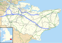
Location within Kent | |
| Population | 429 (2011)[1] |
| District | |
| Shire county | |
| Region | |
| Country | England |
| Sovereign state | United Kingdom |
| Post town | Ashford |
| Postcode district | TN25 |
| Dialling code | 01303 |
| Police | Kent |
| Fire | Kent |
| Ambulance | South East Coast |
| UK Parliament | |
Stanford is a village and civil parish in Kent, England. It is part of the Folkestone and Hythe district.
The village developed along the ancient Roman Stone Street and was divided by the construction of the M20 motorway into Stanford North and Stanford South. Stanford Windmill and parish church of All Saints are in the village.

The parish includes the hamlet of Westenhanger. Folkestone Racecourse was located here; during World War II it served as the RAF Westenhanger airfield, and eventually closed for redevelopment in December 2012.[2] Westenhanger Castle is adjacent to the racecourse. In 2023 the local authority granted planning permission for 8,500 homes at the Otterpool Park site[3][4] which extends from Westenhanger station to the edges of Sellindge and Lympne.
Transport
[edit]Westenhanger railway station serves the parish on the Ashford to Dover line, as well as local buses to Hythe.
References
[edit]- ^ Office for National Statistics. "Parish population 2011". UK government. Retrieved 31 January 2017.
- ^ "Folkestone Racecourse holds 'last' horse racing meeting". BBC News. 18 December 2012. Retrieved 16 February 2024.
- ^ Chessum, Victoria (29 May 2022). "New garden town will change Kent as we know it by 2050". Kent Live. Retrieved 16 February 2024.
- ^ Planning application Y19/0257/FH
External links
[edit]

