Sobradinho, Bahia
Appearance
Sobradinho
Município de Sobradinho | |
|---|---|
 Sobradinho Dam | |
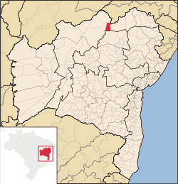
 Location of Sobradinho in Bahia | |
| Coordinates: 09°27′18″S 40°49′22″W / 9.45500°S 40.82278°W | |
| Country | |
| Region | Northeast |
| State | |
| Founded | February 24, 1989 |
| Government | |
| • Mayor | Luiz Vicente Berti Torres Sanjuan (PDT, 2013-2016) |
| Area | |
| • Total | 1,238.9 km2 (478.3 sq mi) |
| Elevation | 380 m (1,250 ft) |
| Population (2020 [1]) | |
| • Total | 23,233 |
| • Density | 19/km2 (49/sq mi) |
| Demonym | Sobradinhense |
| Time zone | UTC−3 (BRT) |
| Website | sobradinho |
Sobradinho (Portuguese pronunciation: [subɾɐˈdʒĩɲu]) is a municipality in the state of Bahia, in Brazil. It has a population of approximately 23,233 with a land area of 1,238.9 km2 (478.3 sq mi). Once part of the municipality of Juazeiro it grew with the construction of the Sobradinho Dam and the flooding of the huge Sobradinho Reservoir. With the creation of the reservoir, the inhabitants of four cities and thirty villages had to leave their homes. In all 11,853 families (more than 70 thousand people) abandoned the old towns before the end of 1977. Of this total, 5,806 families remained in rural lots around the lake and 3,851 families moved to the new towns, including Sobradinho.[2][3]
See also
[edit]References
[edit]- ^ IBGE 2020
- ^ "A Cidade" (in Portuguese). Sobradinho, Bahia, Brazil: Prefeitura Municipal de Sobradinho - Bahia. 2015. Retrieved 2015-02-13.
- ^ "Sobradinho" (in Portuguese). Brasília, Brazil: Instituto Brasileiro de Geografia e Estatística. 2015. Retrieved 2015-08-24.


