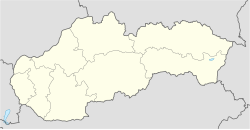
Slaská
Appearance
Slaská | |
|---|---|
Village | |
 A view of the Roman Catholic Church of St. Gall in Slaská. | |
| Coordinates: 48°40′N 18°50′E / 48.667°N 18.833°E | |
| Country | |
| Region | Banská Bystrica Region |
| District | Žiar nad Hronom |
| Government | |
| • Mayor | Daniel Gelien (SME Rodina) |
| Area | |
• Total | 16 km2 (6 sq mi) |
| Population (2024)[3] | |
• Total | 511 |
| • Density | 32/km2 (83/sq mi) |
| Time zone | UTC+1 (CET) |
| • Summer (DST) | UTC+2 (CEST) |
| Postal code | 966 22 |
| Website | www |
Slaská (Hungarian: Mogyorómál) is a village and municipality in Žiar nad Hronom District in the Banská Bystrica Region of central Slovakia.
References
[edit]- ^ "List of elected mayors". volby.statistics.sk. Retrieved 21 May 2024.
- ^ "Land Registration" (PDF). www.skgeodesy.sk. Retrieved 21 May 2024.
- ^ "SODB2021 - Population - Basic results". www.scitanie.sk.

