Skorradalsvatn
Appearance
An editor has performed a search and found that sufficient sources exist to establish the subject's notability. (November 2024) |
| Skorradalsvatn | |
|---|---|
 seen from the west | |
| Coordinates | 64°31′N 21°27′W / 64.517°N 21.450°W |
| Type | Natural lake, reservoir |
| Basin countries | Iceland |
| Max. length | 15 km (9.3 mi) |
| Max. width | 1 km (0.62 mi) |
| Surface area | 14.7 km2 (5.7 sq mi) |
| Max. depth | 48 m (157 ft) |
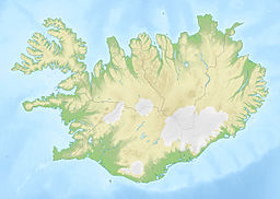
Skorradalsvatn (Icelandic pronunciation: [ˈskɔrːaˌtalsˌvahtn̥] ) is a lake in the west of Iceland. It is situated in a narrow valley between the Hvalfjörður and the valley Reykholtsdalur (see Reykholt). Its length is about 15 km.
Around the lake there are some high mountains, for example Skarðsheiði [ˈskarðsˌheiːðɪ]. Unusually for Iceland, the shores of the lake are quite forested due to reforestation started by a governmental initiative. Consequently, the valley looks a bit like some regions in the Alps, for example near Salzburg in Austria.
The lake is also a reservoir so that the level of the water surface has been raised.
There are no villages on the shores, but many of summer houses.
