Sedlice (Strakonice District)
Sedlice | |
|---|---|
 Church of Saint James the Great | |
| Coordinates: 49°22′38″N 13°56′20″E / 49.37722°N 13.93889°E | |
| Country | |
| Region | South Bohemian |
| District | Strakonice |
| First mentioned | 1352 |
| Government | |
| • Mayor | Vladimír Klíma |
| Area | |
• Total | 30.53 km2 (11.79 sq mi) |
| Elevation | 512 m (1,680 ft) |
| Population (2024-01-01)[1] | |
• Total | 1,310 |
| • Density | 43/km2 (110/sq mi) |
| Time zone | UTC+1 (CET) |
| • Summer (DST) | UTC+2 (CEST) |
| Postal code | 387 32 |
| Website | www |
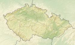
Sedlice is a town in Strakonice District in the South Bohemian Region of the Czech Republic. It has about 1,300 inhabitants. The town centre is well preserved and is protected by law as an urban monument zone.
Administrative parts
[edit]The villages and hamlets of Důl, Holušice, Mužetice and Němčice are administrative parts of Sedlice.
Geography
[edit]Sedlice is located about 13 kilometres (8 mi) north of Strakonice and 58 km (36 mi) northwest of České Budějovice. It lies mostly in the southern tip of the Benešov Uplands. The municipal territory also extends into the Blatná Uplands in the southeast and west. The highest point is the hill Mužetický vrch at 573 m (1,880 ft) above sea level. The area is rich in fishponds.
History
[edit]
The first written mention of Sedlice is from 1352. From 1352 to 1399, Sedlice was a property of Bavors of Strakonice. In the first half of the 15th century, a Gothic fort was built. During the 16th century, Sedlice prospered and developed, and in 1539, the settlement was promoted to a town. In the second half of the 16th century, the fort was rebuilt to a Renaissance castle with a moat.[2]
Demographics
[edit]
|
|
| ||||||||||||||||||||||||||||||||||||||||||||||||||||||
| Source: Censuses[3][4] | ||||||||||||||||||||||||||||||||||||||||||||||||||||||||
Economy
[edit]The town has a tradition of lace production. The tradition started in the 15th century. It reached its greatest expansion in the 19th and early 20th centuries, and continues to this day.[5]
Transport
[edit]
Sedlice is located on the railway line Strakonice–Blatná.[6]
Sights
[edit]The Church of Saint James the Great was built in the Baroque style in 1747–1752, on the site of an old temple from the 14th century.[7]
The castle is one of the landmarks of the town, but today it is dilapidated and inaccessible to the public.
References
[edit]- ^ "Population of Municipalities – 1 January 2024". Czech Statistical Office. 2024-05-17.
- ^ "Historie obce" (in Czech). Město Sedlice. Retrieved 2021-08-22.
- ^ "Historický lexikon obcí České republiky 1869–2011" (in Czech). Czech Statistical Office. 2015-12-21.
- ^ "Population Census 2021: Population by sex". Public Database. Czech Statistical Office. 2021-03-27.
- ^ "Historie Sedlické krajky" (in Czech). Sedlická krajka. Retrieved 2021-08-22.
- ^ "Detail stanice Sedlice" (in Czech). České dráhy. Retrieved 2023-10-30.
- ^ "Kostel sv. Jakuba Většího" (in Czech). National Heritage Institute. Retrieved 2022-08-29.


