Seal Islands (California)
Tools
Actions
General
Print/export
In other projects
Appearance
From Wikipedia, the free encyclopedia
Islands in Suisun Bay, California
 An aerial photo of the Seal islands, viewed from the north, in 2009. | |
| Geography | |
|---|---|
| Location | Northern California |
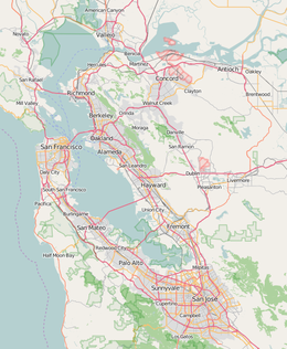
| Coordinates | 38°03′20″N 122°02′50″W / 38.05556°N 122.04722°W / 38.05556; -122.04722 (Seal Islands)[1] |
| Adjacent to | Suisun Bay |
| Administration | |
| State | |
| County | Contra Costa |
This article is about the islands in California's Suisun Bay. For the islands in the Bering Sea, see Seal Islands (Aleutians East).
Seal Islands are a pair of islands in Suisun Bay at the mouth of the Sacramento-San Joaquin River Delta in Contra Costa County, California, 10 km east of Benicia, and 500 metres off-shore from the former Concord Naval Weapons Station and Port Chicago Naval Magazine.
See also
[edit]References
[edit]Map: Islands of Suisun Bay and the Sacramento–San Joaquin River Delta | |
|---|---|
This Contra Costa County, California–related article is a stub. You can help Wikipedia by expanding it. |


