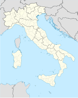
Sanluri
Appearance
You can help expand this article with text translated from the corresponding article in Italian. (June 2022) Click [show] for important translation instructions.
|
Sanluri
Seddori | |
|---|---|
| Comune di Sanluri | |
 Panorama | |
| Coordinates: 39°34′N 8°54′E / 39.567°N 8.900°E | |
| Country | Italy |
| Region | Sardinia |
| Province | South Sardinia |
| Frazioni | Sanluri Stato, San Michele |
| Government | |
| • Mayor | Alberto Urpi |
| Area | |
• Total | 84.16 km2 (32.49 sq mi) |
| Elevation | 633 m (2,077 ft) |
| Population (31 July 2015)[1] | |
• Total | 8,548 |
| • Density | 100/km2 (260/sq mi) |
| Demonym | Sanluresi |
| Time zone | UTC+1 (CET) |
| • Summer (DST) | UTC+2 (CEST) |
| Postal code | 09025 |
| Dialing code | 070 |
| Patron saint | Nostra Signora delle Grazie |
| Saint day | May 31 |
| Website | Official website |
Sanluri (Italian: [sanˈluːri] ; Sardinian: Seddori, Latin: Sullurium) is a comune in Sardinia, Italy. It became part of the Province of South Sardinia, following the creation of that local unit in 2016. The territory of Sanluri comprises an area of 84.16 square kilometres (32.49 sq mi).
In 1436, Sanluri was elevated to viscountship by the Aragonese Crown, and granted to Giovanni de Sena, baron of Quartu Sant'Elena and viscount of Sanluri, the feudalism lasted until the 1800s.
See also
[edit]Wikimedia Commons has media related to Sanluri.
- Battle of Sanluri, 1409.
References
[edit]- ^ "Popolazione Residente al 1° Gennaio 2018". Italian National Institute of Statistics. Retrieved 16 March 2019.


