Rio Casca
Appearance
From Wikipedia, the free encyclopedia
Municipality in Southeast, Brazil
Rio Casca | |
|---|---|
| Municipality of Rio Casca | |
 | |
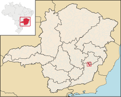
 Location in Minas Gerais | |
| Country | |
| Region | Southeast |
| State | |
| Founded | 1 June 1912 |
| Government | |
| • Mayor | Adriano Alvarenga (PP) |
| Area | |
| • Total | 384.174 km2 (148.330 sq mi) |
| Elevation | 333.87 m (1,095.37 ft) |
| Population (2021)[1] | |
| • Total | 13,384 |
| • Density | 36.95/km2 (95.7/sq mi) |
| Demonym | rio-casquense |
| Time zone | UTC−3 (BRT) |
| Postal Code | 35370-000 to 35379-999 |
| HDI (2010) | 0.650 – medium[2] |
| Website | www |
Rio Casca is a Brazilian municipality located in the state of Minas Gerais. The city belongs to the mesoregion of Zona da Mata and to the microregion of Ponte Nova. As of 2020, the population was 13,473 in a total area of 384 km².[3]
See also
[edit]References
[edit]- ^ "IBGE Rio Casca". IBGE. Retrieved 15 March 2022.
- ^ "Archived copy" (PDF). United Nations Development Programme (UNDP). Archived from the original (PDF) on July 8, 2014. Retrieved August 1, 2013.
{{cite web}}: CS1 maint: archived copy as title (link) - ^ IBGE 2020
20°13′33″S 42°39′03″W / 20.22583°S 42.65083°W / -20.22583; -42.65083
This geographical article relating to Minas Gerais is a stub. You can help Wikipedia by expanding it. |


