Priddy, Texas
Appearance
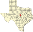
Priddy is an unincorporated community and Census-designated place in Mills County in northwestern Central Texas, United States.[1] The community was established in the late 19th century, and was named after Thomas Jefferson Priddy.[2]
The Priddy Independent School District serves area students.
Climate
[edit]The climate in this area is characterized by relatively high temperatures and evenly distributed precipitation throughout the year. The Köppen Climate System describes the weather as humid subtropical, and uses the abbreviation Cfa.[3]
| Climate data for Priddy, Texas | |||||||||||||
|---|---|---|---|---|---|---|---|---|---|---|---|---|---|
| Month | Jan | Feb | Mar | Apr | May | Jun | Jul | Aug | Sep | Oct | Nov | Dec | Year |
| Mean daily maximum °C (°F) | 21 (69) |
24 (75) |
28 (83) |
32 (90) |
36 (97) |
39 (102) |
38 (101) |
37 (99) |
35 (95) |
31 (87) |
25 (77) |
21 (69) |
31 (87) |
| Mean daily minimum °C (°F) | 1 (34) |
4 (39) |
8 (46) |
12 (54) |
17 (63) |
22 (72) |
23 (74) |
22 (72) |
19 (67) |
13 (56) |
6 (43) |
2 (36) |
13 (55) |
| Average precipitation mm (inches) | 7.6 (0.3) |
10 (0.4) |
5.1 (0.2) |
10 (0.4) |
18 (0.7) |
38 (1.5) |
51 (2) |
46 (1.8) |
43 (1.7) |
25 (1) |
10 (0.4) |
13 (0.5) |
270 (10.8) |
| Source: Weatherbase [4] | |||||||||||||
Demographics
[edit]| Census | Pop. | Note | %± |
|---|---|---|---|
| 2020 | 150 | — | |
| U.S. Decennial Census[5] 1850–1900[6] 1910[7] 1920[8] 1930[9] 1940[10] 1950[11] 1960[12] 1970[13] 1980[14] 1990[15] 2000[16] 2010[17] 2020[18] | |||
Priddy first appeared as a census designated place in the 2020 U.S. Census.[19][17][18]
2020 census
[edit]| Race / Ethnicity (NH = Non-Hispanic) | Pop 2020[18] | % 2020 |
|---|---|---|
| White alone (NH) | 97 | 64.67% |
| Black or African American alone (NH) | 0 | 0.00% |
| Native American or Alaska Native alone (NH) | 0 | 0.00% |
| Asian alone (NH) | 0 | 0.00% |
| Pacific Islander alone (NH) | 0 | 0.00% |
| Other race alone (NH) | 0 | 0.00% |
| Mixed race or Multiracial (NH) | 13 | 8.67% |
| Hispanic or Latino (any race) | 40 | 26.67% |
| Total | 150 | 100.00% |
References
[edit]- ^ U.S. Geological Survey Geographic Names Information System: Priddy, Texas
- ^ "Priddy, Texas". Handbook of Texas Online. Texas State Historical Association. Retrieved May 18, 2017.
- ^ Climate Summary for Priddy, Texas
- ^ "Weatherbase.com". Weatherbase. 2013. Retrieved on September 7, 2013.
- ^ "Decennial Census by Decade". United States Census Bureau.
- ^ "1900 Census of Population - Population of Texas By Counties And Minor Civil Divisions" (PDF). United States Census Bureau.
- ^ "1910 Census of Population - Supplement for Texas" (PDF). United States Census Bureau.
- ^ "1920 Census of Population - Number of Inhabitants - Texas" (PDF). United States Census Bureau.
- ^ "1930 Census of Population - Number of Inhabitants - Texas" (PDF). United States Census Bureau.
- ^ "1940 Census of Population - Number of Inhabitants - Texas" (PDF). United States Census Bureau.
- ^ "1950 Census of Population - Number of Inhabitants - Texas" (PDF). United States Census Bureau.
- ^ "1960 Census of Population - Number of Inhabitants - Texas" (PDF). United States Census Bureau.
- ^ "1970 Census of Population - Number of Inhabitants - Texas" (PDF). United States Census Bureau.
- ^ "1980 Census of Population - Number of Inhabitants - Texas" (PDF). United States Census Bureau.
- ^ "1990 Census of Population - Population and Housing Unit Counts - Texas" (PDF). United States Census Bureau.
- ^ "2000 Census of Population - Population and Housing Unit Counts - Texas" (PDF). United States Census Bureau.
- ^ a b "2010 Census of Population - Population and Housing Unit Counts - Texas" (PDF). United States Census Bureau.
- ^ a b c "P2: Hispanic or Latino, and Not Hispanic or Latino by Race – 2020: DEC Redistricting Data (PL 94-171) – Priddy CDP, Texas". United States Census Bureau.
- ^ "2020 Geography Changes". United States Census Bureau.
External links
[edit]- Cox, Mike. "Priddy Good Sandwiches". Texas Escapes. Blueprints For Travel, LLC.
31°40′24″N 98°30′22″W / 31.67333°N 98.50611°W

