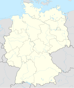
Porschdorf
Appearance
Porschdorf | |
|---|---|
 Panorama of Porschdorf | |
| Coordinates: 50°56′N 14°8′E / 50.933°N 14.133°E | |
| Country | Germany |
| State | Saxony |
| District | Sächsische Schweiz-Osterzgebirge |
| Town | Bad Schandau |
| First mentioned | 1443 |
| Area | |
| • Total | 10.93 km2 (4.22 sq mi) |
| Elevation | 225 m (738 ft) |
| Population (2009)[1] | |
| • Total | 426 |
| • Density | 39/km2 (100/sq mi) |
| Time zone | UTC+01:00 (CET) |
| • Summer (DST) | UTC+02:00 (CEST) |
| Postal codes | 01814 |
| Dialling codes | 035022 |
| Vehicle registration | PIR |
Porschdorf is a former municipality in the Sächsische Schweiz-Osterzgebirge district, in Saxony, in eastern Germany. With effect from 1 January 2012, it has been incorporated into the town of Bad Schandau.[2]
History
[edit]During World War II, in February 1945, a subcamp of the Flossenbürg concentration camp was established, in which some 250 men, mostly Italian, were subjected to forced labour.[3] In April 1945, surviving prisoners were sent on a death march towards the Ore Mountains.[3]
References
[edit]- ^ "Einwohnerzahl von Bad Schandau sinkt" [Population of Bad Schandau decreases]. Sächsische Zeitung (Ausgabe Pirna) (in German). 26 January 2010.
- ^ "Bilanz 2011: 12 freiwillige Gemeindezusammenschlüsse in Sachsen" [Balance 2011: 12 voluntary mergers of municipalities in Saxony] (Press release) (in German). Dresden, Germany: Sächsische Staatskanzlei. 23 December 2011. Retrieved 15 May 2022.
- ^ a b "Porschdorf Subcamp". KZ-Gedenkstätte Flossenbürg. Retrieved 24 October 2023.
External links
[edit] Media related to Porschdorf at Wikimedia Commons
- Porschdorf – Urlaubsort am Lilienstein at the Wayback Machine (archived 11 January 2017)


