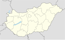
Pettend
Appearance
Pettend | |
|---|---|
Village | |
| Coordinates: 46°00′03″N 17°41′58″E / 46.00086°N 17.69931°E | |
| Country | Hungary |
| Region | Southern Transdanubia |
| County | Baranya |
| Government | |
| • Mayor | Lakatos Sándor[1] |
| Population (2012)[2] | |
| • Total | 149 |
| Time zone | UTC+1 (CET) |
| • Summer (DST) | UTC+2 (CEST) |
| Postal code | 7972 |
| Area code | +36 |
| KSH code | 29762[3] |
Pettend (Croatian: Petan[4]) is a village in Szigetvári district of Baranya County, Hungary. As of 2012 it had a population of 149.
Pettend lies to the south of the confluence of the Szigetvár and Kistamási rivers.
History
[edit]The first mention of Pettend was in 1330, spelled Petend, and assigned to the estate of Peter Siklosi. In 1449 the land was divided between three families of landed gentry, Thuz, Letai, and Szőcsényi. In 1493 the estate was bought by Mihályné Kornis, that is, the wife of Mihály Kornis.[5] In the 18th century, Count Laszló Nádasdy inhabited the area. In the 20th century, with changes in boundaries, it became part of Somogy County.
Notable people
[edit]References
[edit]- ^ "Pettend települési választás eredményei" (in Hungarian). Országos Választási. 3 October 2010. Retrieved 15 December 2011.
- ^ Pettend at the Hungarian Central Statistical Office (Hungarian). 2012
- ^ a b Pettend at the Hungarian Central Statistical Office (Hungarian).
- ^ "Folia onomastica croatica 14/2005" (pdf). Živko Mandić: Hrvatska imena naseljenih mjesta u Madžarskoj (in Croatian). Retrieved 25 July 2012.
- ^ "Pettend" (in Hungarian). Utazom.com. Retrieved 5 May 2015.
Wikimedia Commons has media related to Pettend.


