Părău
Appearance
Părău | |
|---|---|
 Church of the Dormition in Veneția de Jos | |
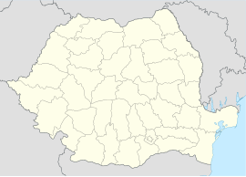
 Location within the county | |
| Coordinates: 45°51′N 25°11′E / 45.850°N 25.183°E | |
| Country | Romania |
| County | Brașov |
| Government | |
| • Mayor (2020–2024) | Ovidiu-Alexandru Ovesea[1] (PMP) |
| Area | 111.62 km2 (43.10 sq mi) |
| Elevation | 443 m (1,453 ft) |
| Population (2021-12-01)[2] | 2,091 |
| • Density | 19/km2 (49/sq mi) |
| Time zone | EET/EEST (UTC+2/+3) |
| Postal code | 507155 |
| Area code | (+40) 02 68 |
| Vehicle reg. | BV |
| Website | comuna-parau |
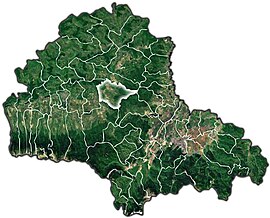
Părău (German: Mikesdorf-Berau; Hungarian: Páró) is a commune in Brașov County, Transylvania, Romania. It is composed of four villages: Grid, Părău, Veneția de Jos (Untervenitze; Alsóvenice), and Veneția de Sus (Felsővenice).
The commune is situated in the center of the county, in the historic Țara Făgărașului region. It lies on the left bank of the Olt River. The river Veneția discharges into the Olt near Veneția de Jos, while the river Părău flows into the Olt near the village Părău.
Părău is crossed by the national road DN1S, which runs from Șercaia to Hoghiz. It is located at a distance of 19 kilometres (12 mi) from Făgăraș and 60 km (37 mi) from Brașov.
Natives
[edit]- Aurel Cornea (1933 – 2005), mathematician
- Dimitrie Eustatievici (1730 – 1796), philologist, scholar, and pedagogue
References
[edit]- ^ "Results of the 2020 local elections". Central Electoral Bureau. Retrieved 9 June 2021.
- ^ "Populaţia rezidentă după grupa de vârstă, pe județe și municipii, orașe, comune, la 1 decembrie 2021" (XLS). National Institute of Statistics.


