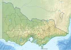
Mount Selma
| Mount Selma | |
|---|---|
| Highest point | |
| Elevation | 1,463 metres (4,800 ft) AHD[1] |
| Coordinates | 37°37′22″S 146°26′2″E / 37.62278°S 146.43389°E[2] |
| Geography | |
| Location | Victoria, Australia |
| Parent range | Great Dividing Range |
Mount Selma is a mountain located to the north-east of Aberfeldy in Victoria, Australia.[3][2] Its peak is 1463 metres above sea level.[1] The headwaters of the Aberfeldy River rise on its southerly slopes.[4]
Access
[edit]The unsealed Mount Selma Road passes to the north of the summit and divides the Toombon State Forest (to the south) from Licola State Forest (to the north).[5] The summit of the mountain has a trigonometrical station and is accessible by four-wheel drive vehicles via Mount Selma Track. The Australian Alps Walking Track follows the alignment of Mount Selma Road.[6] [7]
Bushfires
[edit]In the summer of 2006-2007, the area was burned during the Eastern Victoria Great Divide bushfires.[8] Before the fire reached the mountain, the army was called in to provide heavy machinery to clear a firebreak along Mount Selma Track to protect the Thomson Reservoir catchment.[9] Christians Hut, a mountain hut near Mount Selma, was destroyed by the bushfires.[10]
Flora
[edit]The Selma Saddle Grevillea (Grevillea miqueliana subsp. cincta) is endemic to a small area near Mount Selma. Road works, logging and controlled burning are potential threats to the population The subspecies is listed as "endangered" on the Advisory List of Rare Or Threatened Plants In Victoria - 2014.[11]
See also
[edit]References
[edit]- ^ a b Mansfield - Baw Baw Four-Wheel-Drive Map (Map) (1 ed.). 1:100,000. Spatial Vision.
- ^ a b "Place Names Search: MOUNT SELMA". Geoscience Australia. Retrieved 29 January 2012.[permanent dead link]
- ^ Melway Greater Melbourne Street Directory (Map) (33 ed.). Ausway Publishing. 2006. p. 628.
- ^ "Upper Thomson River System" (PDF). Protecting critical aquatic ecosystems. Retrieved 29 January 2011.
- ^ "Central Area -0 Baw Baw" (PDF). Draft Fire Management Zones. 30 June 2011. Retrieved 29 January 2011.
- ^ "Alpine Area Special Investigation" (PDF). Land Conservation Council (Victoria). Retrieved 29 January 2012.
- ^ Map 2 Thomson Valley Road - Mt. Shillinglaw 50 km (PDF) (Map). Australian Alps Walking Map. Retrieved 29 January 2012.
- ^ Eastern Victoria Great Divide Fires - Contained as at 0700hr 7/2/2007 (PDF) (Map). Retrieved 29 January 2012.
- ^ Sheppard, Martine (14 December 2006). "Army called to protect dam". Latrobe Valley Express. Retrieved 29 January 2012.[permanent dead link]
- ^ "Echo from the Mountains" (PDF). 5 (1). Victorian High Country Huts Association. March 2007. ISSN 1448-3769. Archived from the original (PDF) on 18 March 2012. Retrieved 29 January 2012.
{{cite journal}}: Cite journal requires|journal=(help) - ^ "Advisory List of Rare Or Threatened Plants In Victoria - 2014". Department of Environment and Primary Industries (Victoria). Retrieved 22 December 2014.
