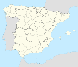
Moraleja
Appearance
Moraleja | |
|---|---|
municipality | |
| Coordinates: 40°04′N 6°39′W / 40.067°N 6.650°W | |
| Country | Spain |
| Autonomous community | Extremadura |
| Province | Cáceres |
| Comarca | Sierra de Gata |
| Area | |
• Total | 124.54 km2 (48.09 sq mi) |
| Elevation | 261 m (856 ft) |
| Population (2018)[1] | |
• Total | 6,792 |
| • Density | 55/km2 (140/sq mi) |
| Time zone | UTC+1 (CET) |
| • Summer (DST) | UTC+2 (CEST) |
Moraleja (Spanish: [moɾaˈlexa] ) is a municipality located in the province of Cáceres, Extremadura, Spain. It is the most important town in the Sierra de Gata comarca. The Postal Code is 10128.
The Town Hall is currently heavily indebted.[2] This municipality is included in the Sierra de Gata comarca, although it is in the Árrago River basin, geographically not in the mountainous area of the Sierra de Gata.
Villages
[edit]References
[edit]- ^ Municipal Register of Spain 2018. National Statistics Institute.
- ^ El Ayuntamiento de Moraleja recurrirá a 'Anticipos a cuenta' para pagar las nóminas
External links
[edit]40°04′N 6°39′W / 40.067°N 6.650°W


