Montorgiali
Appearance
Montorgiali | |
|---|---|
 View of the castle and the church | |
| Coordinates: 42°44′18″N 11°17′57″E / 42.73833°N 11.29917°E | |
| Country | Italy |
| Region | |
| Province | Grosseto (GR) |
| Comune | Scansano |
| Elevation | 330 m (1,080 ft) |
| Population (2011) | |
| • Total | 162 |
| Demonym | Montorgialesi |
| Time zone | UTC+1 (CET) |
| • Summer (DST) | UTC+2 (CEST) |
| Postal code | 58054 |
| Dialing code | (+39) 0564 |
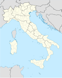
Montorgiali is a village in Tuscany, central Italy, administratively a frazione of the comune of Scansano, province of Grosseto. At the time of the 2001 census its population amounted to 141.[1]
Montorgiali is about 21 km from Grosseto and 10 km from Scansano, and it is situated on a hill along the Scansanese Provincial Road.
Main sights
[edit]- San Biagio (12th century), main parish church of the village
- Sanctuary of San Giorgio, old pieve during the Middle Ages, it is now a sanctuary dedicated to Saint George who, according to legend, defeated a dragon
- Castle of Montorgiali (12th century), main palace in the village
References
[edit]Bibliography
[edit]Wikivoyage has a travel guide for Montorgiali.
- Aldo Mazzolai, Guida della Maremma. Percorsi tra arte e natura, Le Lettere, Florence, 1997.
- Giuseppe Guerrini, Torri e castelli della Provincia di Grosseto, Nuova Immagine Editrice, Siena, 1999.
See also
[edit]Wikimedia Commons has media related to Montorgiali.
