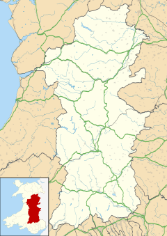
Llanyre
Llanyre
| |
|---|---|
Location within Powys | |
| Population | 1,141 (2011)[1] |
| OS grid reference | SO045625 |
| Principal area | |
| Preserved county | |
| Country | Wales |
| Sovereign state | United Kingdom |
| Post town | Llandrindrod Wells |
| Postcode district | LD1 |
| Dialling code | 01597 |
| Police | Dyfed-Powys |
| Fire | Mid and West Wales |
| Ambulance | Welsh |
| UK Parliament | |
| Senedd Cymru – Welsh Parliament | |
Llanyre (Welsh: Llanllŷr or Llanllŷr-yn-Rhos ) is a village and electoral ward in Radnorshire, Powys, Wales. The community had a population of 1,061 in 2001,[2] increasing to 1,141 at the 2011 Census. It includes the village of Newbridge-on-Wye.
Location
[edit]Llanyre is to the west of Llandrindod Wells, in the upper Wye Valley. The area is largely rural.
Architecture
[edit]Housing in Llanyre comprises an eclectic mix of nineteenth century stone and brick housing, with newer, more modern housing schemes currently under development.[3]
Administration
[edit]Local administration is undertaken by the Llanyre Community Council, which is divided into two community wards, Newbridge with six members and Llanyre/Llanfihangel with five. It was previously divided into three community wards, consisting of 12 elected members, as such:
- Llanfihangel Helygen - 2 members, 44 electors.
- Llanyre Rural - 5 members, 400 electors.
- Llanyre Village - 5 members, 496 electors.
Meetings are held every third Tuesday in the month, excluding August.[4]
Llanyre was a county electoral ward until 2022. The electorate of Llanyre ward was 940 in 2005.[5] Following a boundary review, the Llanyre county ward was substantially added to, with three neighbouring communities (Abbey Cwmhir, Nantmel and St Harmon) being added, and it was renamed Llanyre and Nantmel as a consequence. Newbridge was combined with Disserth and Trecoed community to form the Disserth and Trecoed with Newbridge county ward. The changes were effective from the 2022 local elections.[6]
Church of St Llyr
[edit]
The Church of St Llyr lies to the south of the village, on the west of the A4081 road to Rhayader. Rebuilt entirely from 1885 to 1887,[7] little remains of the original church apart from the very front of the building. The churchyard contains one war grave, of a Royal Flying Corps officer of World War I.[8]
It is a grade II* listed building.[9]
References
[edit]- ^ "Ward/Community population 2011". Retrieved 13 November 2015.
- ^ 2001 Census
- ^ "Welcome to Llanyre Community Council - Llanyre Community Council". llanyre.org.uk. Retrieved 3 May 2023.
- ^ About Llanyre Community Council Archived 2007-04-23 at the Wayback Machine
- ^ "Community No. R18 - LLANYRE" (PDF). Archived from the original (PDF) on 29 September 2007. Retrieved 3 May 2023.
- ^ "The County of Powys (Electoral Arrangements) Order 2021". legislation.gov.uk. The National Archives. Retrieved 12 May 2022.
- ^ "Llanyre a Swansea and Brecon Diocesan Church". Archived from the original on 28 September 2007. Retrieved 3 May 2023.
- ^ CWGC casualty record cwgc.org
- ^ "Church of St Michael, Llanyre". British Listed Buildings. Retrieved 15 December 2013.

