Kottmar
Appearance
You can help expand this article with text translated from the corresponding article in German. (July 2010) Click [show] for important translation instructions.
|
| Kottmar | |
|---|---|
 Kottmar seen from Ebersbach | |
| Highest point | |
| Elevation | 583 m (1,913 ft) |
| Coordinates | 51°0′37″N 14°39′21″E / 51.01028°N 14.65583°E |
| Geography | |
| Parent range | Lusatian Highlands |
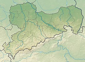
The Kottmar is a mountain in Saxony, southeastern Germany. It is part of the Upper Lusatian Highlands (Oberlausitzer Bergland). Its elevation is 583m.[1]
The Kottmar is an extinct Volcano from the Tertiary and made up of Phonolite.[2]
At the foot of the Kottmar, one of the three sources of the river Spree as well as the Cunnersdorfer Wasser and the brook "Petersbach" have their springs. The Cunnersdorfer Wasser joins with the Spree and they empty into the North Sea, while the Petersbach empties into the Baltic Sea via the Neisse and Oder, which makes the Kottmar part of the Upper Lusatian Water divide.[2]
References
[edit]- ^ "GeoData portal of the Bundesamt für Naturschutz (Federal Agency for Nature Conservation)" (in German). Retrieved 15 October 2024.
- ^ a b "Gemeinde Kottmar - Der Kottmar". www.gemeinde-kottmar.de (in German). Retrieved 2024-10-15.
External links
[edit]Wikimedia Commons has media related to Kottmar.
