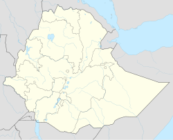
Jinka
Jinka
ጂንካ | |
|---|---|
 Market in Jinka | |
| Coordinates: 5°47′N 36°34′E / 5.783°N 36.567°E | |
| Country | |
| Region | |
| Zone | Ari Zone |
| Elevation | 1,490 m (4,890 ft) |
| Population (2005) | |
• Total | 30,249 |
| Time zone | UTC+3 (EAT) |
| • Summer (DST) | UTC+3 (not observed) |
| Climate | Aw |
Jinka is a market town in southern Ethiopia. Located in the hills north of the Tama Plains, this town is the capital of the Ari Zone of the South Ethiopia Regional State. Currently Jinka is the center of Jinka town administration. Jinka has a latitude and longitude of 5°47′N 36°34′E / 5.783°N 36.567°E and an elevation of 1490 meters above sea level. It is one of the most famous tourist destinations in the country. It is also an important center for at least sixteen indigenous ethnic groups as well as others from the rest of the country.
Overview
[edit]Jinka is home to the German-funded South-Omo Museum and Research Center[1] and an airstrip (IATA code BCO[2]). Postal service is provided by a main branch; electricity and telephone service are also available.[3] Its market day is Saturday. The Mago National Park, 40 kilometers south by unpaved road, is a nearby attraction.
The local clinic was reported in 1996 to be in the process of upgrading to hospital status, which would become the first in the south omo Zone.[4] According to the SNNPR's Bureau of Finance and Economic Development, as of 2003[update] Jinka's amenities include digital telephone access, postal service, electricity provided by a diesel generator, a bank and a hospital.[5] Jinka increased its electrical service from 16 to 24 hours a day in May 2009 when the town obtained additional generators.[6]
Demographics
[edit]Based on figures from the Central Statistical Agency in 2005, Jinka has an estimated total population of 22,475 of whom 11,774 are men and 10,701 are women.[7] Previous population figures vary: the 1994 national census reported this town had a total population of 12,407 of whom 6,519 were men and 5,888 were women; another source states in 1993 there were a total of 9,520 inhabitants.[8]
Climate
[edit]| Climate data for Jinka, elevation 1,430 m (4,690 ft), (1971–2000) | |||||||||||||
|---|---|---|---|---|---|---|---|---|---|---|---|---|---|
| Month | Jan | Feb | Mar | Apr | May | Jun | Jul | Aug | Sep | Oct | Nov | Dec | Year |
| Mean daily maximum °C (°F) | 29.7 (85.5) |
30.0 (86.0) |
29.8 (85.6) |
26.8 (80.2) |
25.5 (77.9) |
24.7 (76.5) |
24.3 (75.7) |
24.7 (76.5) |
25.4 (77.7) |
26.0 (78.8) |
26.9 (80.4) |
29.0 (84.2) |
26.9 (80.4) |
| Mean daily minimum °C (°F) | 14.2 (57.6) |
15.3 (59.5) |
16.6 (61.9) |
16.6 (61.9) |
16.2 (61.2) |
15.6 (60.1) |
15.3 (59.5) |
15.3 (59.5) |
15.4 (59.7) |
15.9 (60.6) |
14.2 (57.6) |
13.6 (56.5) |
15.4 (59.6) |
| Average precipitation mm (inches) | 47.0 (1.85) |
71.0 (2.80) |
107.0 (4.21) |
178.0 (7.01) |
167.0 (6.57) |
107.0 (4.21) |
94.0 (3.70) |
120.0 (4.72) |
130.0 (5.12) |
169.0 (6.65) |
126.0 (4.96) |
29.0 (1.14) |
1,345 (52.94) |
| Average relative humidity (%) | 60 | 63 | 68 | 72 | 76 | 76 | 62 | 59 | 62 | 78 | 57 | 67 | 67 |
| Source: FAO[9] | |||||||||||||
Notes
[edit]- ^ Described in Phillips, Matt and Carillet, Jean-Bernard Ethiopia and Eritrea, 3rd ed. (London: Lonely Planet, 2006), p. 203
- ^ The destination for inbound flights is still described as Baco, an older name for the town
- ^ "Detailed statistics on infrastructure" Archived 2011-07-20 at the Wayback Machine, Southern Nations, Nationalities and People's Region, Bureau of Finance and Economic Development website (accessed 27 September 2009)
- ^ "Preliminary examination of major factos affecting subsistence economy of South Omo Zone and Konso special wereda in South-western Ethiopia" UNDP-EUE Report, May 1996 (accessed 22 January 2009)
- ^ "Detailed statistics on hotels and tourism" Archived 2011-05-31 at the Wayback Machine, Bureau of Finance and Economic Development website (accessed 4 September 2009)
- ^ "Jinka town benefits from 24-hour electric power service"[permanent dead link], Ethiopian News Agency 10 May 2009 (accessed 30 May 2009)
- ^ CSA 2005 National Statistics Archived 2006-11-23 at the Wayback Machine, Table B.4
- ^ "Local History in Ethiopia"[permanent dead link] (PDF) The Nordic Africa Institute website (accessed 26 November 2007)
- ^ "CLIMWAT climatic database". Food and Agriculture Organization of United Nations. Retrieved 24 June 2024.
