Sierra de Javalambre
| Sierra de Javalambre | |
|---|---|
 Sierra de Javalambre rising above Pina | |
| Highest point | |
| Elevation | 2,020 m (6,630 ft) |
| Listing | Mountains of Aragon, List of mountains in the Valencian Community |
| Coordinates | 40°5′49.7″N 1°1′29″W / 40.097139°N 1.02472°W |
| Geography | |
| Location | Gúdar-Javalambre, Aragon Rincón de Ademuz and Serrans, Valencian Community |
| Parent range | Iberian System, Eastern zone |
| Geology | |
| Mountain type | Karstic (Jurassic) |
| Climbing | |
| Easiest route | From the towns of La Puebla de Valverde, Ademuz or Riodeva |
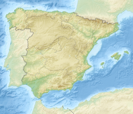
Sierra de Javalambre (Aragonese: Sierra de Chabalambre; Arabic: جبل الْحَمْرَاء, romanized: jabal al-ḥamrāʼ ))[1] is a 29 km (18 mi) long mountain range in the Gúdar-Javalambre comarca of Aragon and the Rincón de Ademuz and Serrans comarcas of the Valencian Community, Spain.
Highway N-234 winds its way between Sierra de Javalambre and Serra d'Espadà reaching the coast at Sagunto and the Autopista AP-7.
Location
[edit]This mountain range is located at the eastern end of the Iberian System and the Sierra del Toro its ESE prolongation. Its highest point is Javalambre (2,020 m).
Summits
[edit]Its summits are usually covered in snow in the winter and the 1,839 m high Cerro Calderón or Alto de las Barracas is the highest peak of the Land of Valencia. Aramón Javalambre is a small ski resort in the range with 12.2 km of ski trails.[2] The Buitre summit hosts the Astrophysical Observatory of Javalambre.
See also
[edit]References
[edit]- ^ Ignacio de Asso, Historia de la Economía Política de Aragón, 1798
- ^ Aramón Javalambre
External links
[edit] Media related to Sierra de Javalambre at Wikimedia Commons
- enciclopedia.cat - Javalambre
- Sierra de Javalambre
- Infoaventura
- Todonieve
- Camarena de la Sierra
