Inklin River
| Inklin River | |
|---|---|
| Location | |
| Country | Canada |
| Province | British Columbia |
| Physical characteristics | |
| Source | Stikine Plateau |
| • location | Coast Mountains |
| • coordinates | 58°46′35″N 132°5′36″W / 58.77639°N 132.09333°W[2] |
| • elevation | 314 m (1,030 ft)[3] |
| Mouth | Taku River |
• location | Boundary Ranges |
• coordinates | 58°54′10″N 133°8′37″W / 58.90278°N 133.14361°W[1] |
• elevation | 91 m (299 ft)[3] |
| Length | 83 km (52 mi)[4] |
| Basin size | 10,463 km2 (4,040 sq mi),[5] |
| Discharge | |
| • average | 177 m3/s (6,300 cu ft/s).[5] |
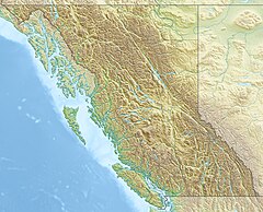
The Inklin River (Lingít: Héen Tlein) is a tributary of the Taku River in the northwest part of the province of British Columbia, Canada.[1] It originates at the confluence of its two main tributaries, the Nahlin River and the Sheslay River[6] and flows generally west and northwest about 83 km (52 mi)[4] to join the Nakina River.[7] The confluence of the Inklin and Nakina Rivers, at the uninhabited locality of Inklin, [8] marks the beginning of the Taku River. The mouth of the Inklin River is located about 100 km (62 mi) northeast of Juneau, Alaska and about 160 km (99 mi) northwest of Telegraph Creek, British Columbia.
The river forms the southwestern boundary of the Taku Plateau, the northwesternmost sub-plateau of the Stikine Plateau. Along the river's southeast are the Boundary Ranges of the Coast Mountains.
The Inklin River's watershed covers 10,463 km2 (4,040 sq mi),[5] and its mean annual discharge is 177 m3/s (6,300 cu ft/s).[5]
The lower Inklin River flows through the Nakina–Inklin Rivers/Yáwu Yaa Conservancy.[9][10]
Major tributaries of the Inklin River include Yeth Creek,[11] Sutlahine River,[12] Kaustua Creek,[13] Kowatua Creek,[14] Teditua Creek,[15] and its headwater rivers, the Nahlin and Sheslay Rivers.
See also
[edit]References
[edit]- ^ a b "Inklin River". BC Geographical Names.
- ^ "Nahlin River". BC Geographical Names.
- ^ a b Elevation derived from ASTER Global Digital Elevation Model, using GeoLocator, BCGNIS coordinates, and topographic maps.
- ^ a b Length measured using Google Maps path tool, BCGNIS coordinates, topographic maps, and TopoQuest.
- ^ a b c d "Northwest Water Tool". BC Water Tool. GeoBC, Integrated Land Management Bureau, Ministry of Agriculture and Lands, Government of British Columbia. Retrieved 4 August 2021.
- ^ Lord, Nancy (2009). Rock, Water, Wild: An Alaskan Life. University of Nebraska Press. p. 97. ISBN 0-8032-2609-8. Retrieved 12 August 2021.
- ^ "Nakina River". BC Geographical Names.
- ^ "Inklin (rescinded)". BC Geographical Names.
- ^ "Nakina – Inklin Rivers/Yáwu Yaa Conservancy". BC Parks. Retrieved 12 August 2021.
- ^ "Nakina-Inklin Rivers/Yáwu Yaa Conservancy". BC Geographical Names.
- ^ "Yeth Creek". BC Geographical Names.
- ^ "Sutlahine River". BC Geographical Names.
- ^ "Kaustua Creek". BC Geographical Names.
- ^ "Kowatua Creek". BC Geographical Names.
- ^ "Teditua Creek". BC Geographical Names.
