Ignești
Ignești | |
|---|---|
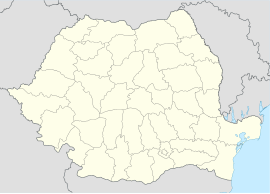
 Location in Arad County | |
| Coordinates: 46°24′N 22°10′E / 46.400°N 22.167°E | |
| Country | Romania |
| County | Arad |
| Population (2021-12-01)[1] | 601 |
| Time zone | EET/EEST (UTC+2/+3) |
| Vehicle reg. | AR |
Ignești (Hungarian: Ignafalva) is a commune in Arad County, Romania, is situated at the southern foot of Codru-Moma Mountains, in the Ineu-Gurahonț Basin. The commune stretches over 5192 hectares and is composed of four villages: Ignești (situated at 89 km from Arad), Minead (Menyéd), Nădălbești (Nádalmás) and Susani (Susányfalva).
Population
[edit]According to the 2002 census the population of the commune counts 822 inhabitants, out of which 99.4% are Romanians and 0.6% are Hungarians.
Istoric
[edit]The first documentary record of the locality Ignești dates back to 1553. The other settlements were attested documentary as it follows: Minead in 1619, Nadalbești in 1553 and Susani in 1574.
Economy
[edit]The economy of the commune is mainly agricultural, livestock-breeding and plant-growing being well represented. Apiculture is also present on the economic map of the commune.
Tourism
[edit]Ignești commune can become an area with touristic attraction by trimming up its anthropic and natural potential.

