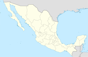
Huayacocotla
Appearance
Huayacocotla | |
|---|---|
Town and municipal seat | |
| Coordinates: 20°33′0″N 98°29′0″W / 20.55000°N 98.48333°W | |
| Country | |
| State | Veracruz |
| Municipality | Huayacocotla |
| Settled | pre-Conquest |
| Town status | 27 May 1881 |
| Elevation | 2,149 m (7,051 ft) |
| Population (2005) | |
• Total | 3,847 |
| Website | www.huayacocotla.gob.mx |
Huayacocotla is a town (villa) in the Mexican state of Veracruz. Located in the state's Huasteca Baja region, it serves as the municipal seat for the surrounding municipality of the same name.
In the 2005 INEGI Census, Huayacocotla reported a total population of 3,847.[1]
Name
[edit]"Huayacocotla" comes from the Nahuatl elements hueyi (large) coautli (tree) and tla (particle of abundance). It therefore means "place of large trees".
Media
[edit]Huayacocotla is home to XHFCE-FM, an indigenous community radio station, now broadcasting on the VHF band but previously operating for 30 years on short-wave frequencies as XEJN-OC.
References
[edit]Wikimedia Commons has media related to Huayacocotla.
- ^ "Huayacocotla". Enciclopedia de los Municipios de México. Instituto Nacional para el Federalismo y el Desarrollo Municipal. Archived from the original on 17 November 2006. Retrieved 9 November 2008.
