Honaz
Honaz
Colossae | |
|---|---|
District and municipality | |
 | |
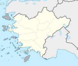
 Map showing Honaz District in Denizli Province | |
| Coordinates: 37°45′28″N 29°15′51″E / 37.75778°N 29.26417°E | |
| Country | Turkey |
| Province | Denizli |
| Government | |
| • Mayor | Yüksel Kepenek (CHP) |
| Area | 449 km2 (173 sq mi) |
| Population (2022)[1] | 34,074 |
| • Density | 76/km2 (200/sq mi) |
| Time zone | UTC+3 (TRT) |
| Postal code | 20330 |
| Area code | 0258 |
| Website | www |
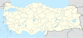
Honaz (also known as Khonaz or Cadmus) is a municipality and district of Denizli Province, Turkey.[2] Its area is 449 km2,[3] and its population is 34,074 (2022).[1]
Honaz is about 20 km (12 mi) east of the city of Denizli on the slopes of the mountain of the same name – Mount Honaz (Honaz Dağı). The mountain is the highest peak in Turkey's Aegean Region (2517 m). Just north of Honaz is Honaz Stream (Honaz Çayı), known in ancient times as the Lycus.
History
[edit]In antiquity it was known as Colossae. At 500 BC Colossae was founded by the Phrygians, and then passed into the hands of the Ancient Greeks. Herodotus and Xenophon both record the passage of Greek and Persian armies though here during the Persian Wars, at that time it was a large Phrygian city. A few ruins of the ancient city remain. Like many other ancient cities of the region, Colossae was destroyed by earthquakes, with little surviving.
In the Byzantine period its name was Chonai. The city and a bishopric of Chonai was established at the location of the present Honaz township by the Byzantines during the Arab invasions of the 7th century. Being further up the mountain the location was easier to defend. Following centuries of Byzantine rule the town was first captured by the Seljuk Turks in 1070, but was then reconquered during the Komnenian period. During the reign of Manuel I Komnenos it prospered as a frontier town, a trading and pilgrimage venue for both Christians and Muslims. The forces of Louis VII of France, en route to the Holy Land as part of the Second Crusade, were attacked here by the Turks in the battle of Mount Cadmus of 1148.[4] The Byzantine chronicler Niketas Choniates (c. 1155-1215/1216) was a native of the city. Chonai was plundered twice by local independent warlords backed by the Turks (by Theodoros Mankaphas in late 1180s and by Pseudo-Alexios in 1192). It finally fell to the Seljuks soon afterwards. Kaykhusraw I promised to return it to the Byzantines, but in view of the collapse of imperial power caused by the Fourth Crusade and the Latin conquest of Constantinople he decided rather to assign it to his father-in-law, the Byzantine renegade Manuel Maurozomes. The latter held it as an autonomous lordship together with Laodikeia, near present-day Denizli, from 1205 until his death ca. 1230. Theodore I Laskaris came to accept it in a 1206 agreement with Kaykhusraw I.
There is a Seljuk fortress in Honaz, and the Murat Mosque which dates back to the reign of Ottoman Sultan Murat II (imperabat 1404–1451).
In the 20th century, Honaz was one of the places where the Vallahades or Valaades (ethnic Greek Muslims from southwest Greek Macedonia) were forced to resettle during the Population exchange between Greece and Turkey of 1922–23.[5]
Composition
[edit]There are 22 neighbourhoods in Honaz District:[6]
- Afşinbey
- Akbaş
- Aşağıdağdere
- Aydınlar
- Cumhuriyet
- Dereçiftlik
- Emirazizli
- Gürleyik
- Haydar
- Hisar
- Hürriyet
- Kaklık
- Karaçay
- Karateke
- Kızılyer
- Kocabaş
- Menteşe
- Ovacık
- Sapaca
- Yeni
- Yokuşbaşı
- Yukarıdağdere
Honaz today
[edit]Today the economy of Honaz is centred on growing cherries, 80% of the crop being exported from Turkey, generating up to 35 million dollars of income per annum. There is an annual cherry festival in the town. Tomatoes and other fruits and vegetables are grown too including a local variety of oleaster.
Honaz is also the homeland of a number of well-known pehlivans (oil wrestlers) including the 3-time national champion Hüseyin Çokal.
In the nearby depending township of Kaklık, there is a large cave called "Kaklık Cave" or "Kaklık Mağarası" which attracts visitors from all over the country. A spring that spurts out on the surface only to flow back underground shortly afterwards through the cave in cascading layers of limestone and travertine caused Kaklık to appear very much like a subterranean Pamukkale.
References
[edit]- ^ a b "Address-based population registration system (ADNKS) results dated 31 December 2022, Favorite Reports" (XLS). TÜİK. Retrieved 12 July 2023.
- ^ Büyükşehir İlçe Belediyesi, Turkey Civil Administration Departments Inventory. Retrieved 12 July 2023.
- ^ "İl ve İlçe Yüz ölçümleri". General Directorate of Mapping. Retrieved 12 July 2023.
- ^ Baldwin, Marshall W., and Setton, Kenneth M, A History of the Crusades: Volume One, The First Hundred Years, 1969., pgs. 499, 624, 634.
- ^ Koukoudis, Asterios (2003). The Vlachs: Metropolis and Diaspora. Zitros. p.198
- ^ Mahalle, Turkey Civil Administration Departments Inventory. Retrieved 12 July 2023.
- Klaus Belke, Norbert Mersich, Phrygien und Pisidien, Tabula Imperii Byzantini VII, Wien 1990, s. 309–311.
- O City of Byzantium, Annals of Niketas Choniates, ed. Harry J. Magoulias, Detroit, MI 1984.
- Claude Cahen, The Formation of Turkey. The Seljukid Sultanate of Rum: Eleventh to Fourteenth Century, Harlow 2001.


