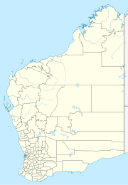
Higginsville, Western Australia
Appearance
| Higginsville Western Australia | |
|---|---|
 | |
| Coordinates | 31°45′00″S 121°43′00″E / 31.75000°S 121.71667°E |
| Population | 19 (SAL 2021)[1] |
| Established | 1907 |
| Postcode(s) | 6443 |
| Area | 1,025.4 km2 (395.9 sq mi) |
| Location | |
| LGA(s) | Shire of Coolgardie |
| State electorate(s) | Eyre |
| Federal division(s) | O'Connor |
Higginsville is a town in the Goldfields-Esperance Region of Western Australia.[2] According to the 2016 census, Higginsville had a population of 66.
The town was gazetted in 1907 and is believed to have been named after the prospector Patrick Justice Higgins.[2]
The town is located on the Esperance branch railway, west of Lake Cowan. The currently active Higginsville Gold Mine is located nearby.
See also
[edit]References
[edit]- ^ Australian Bureau of Statistics (28 June 2022). "Higginsville (suburb and locality)". Australian Census 2021 QuickStats. Retrieved 28 June 2022.
- ^ a b History of country town names - H Archived 12 March 2010 at the Wayback Machine Landgate website, accessed: 25 January 2010
