Filingué
Appearance
Filingué | |
|---|---|
Town | |
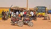
 Scene in the town's centre | |
| Coordinates: 14°21′0″N 3°19′0″E / 14.35000°N 3.31667°E | |
| Country | |
| Region | Tillabéri Region |
| Department | Filingué Department |
| Area | |
| • Town | 4,420 km2 (1,710 sq mi) |
| Elevation | 225 m (738 ft) |
| Population (2012 Institut National de la Statistique du Niger) | |
| • Town | 92,097 |
| • Urban | 12,590 |
| Ethnic breakdown: 70% Fulani, 10% Djerma, 10% Tuareg, 5% Hausa, 5% originating from neighbouring countries. | |
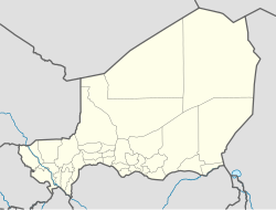
Filingué is a town in southwestern Niger and is the capital city of Filingué Department. It is situated on the eastern bank of the Dallol Bosso valley, some 180 km northeast of Niger's capital city Niamey.
As pools of stagnant water remain in this valley in the dry season there's a lot of mudbrick making.
Gallery
[edit]-
Scene at the bus station
-
Preparing meat skewers
-
Brick making on the outskirts of town
14°20′58″N 3°19′44″E / 14.349548°N 3.328857°E


