Champsecret
You can help expand this article with text translated from the corresponding article in French. (December 2008) Click [show] for important translation instructions.
|
Champsecret | |
|---|---|
 The town hall in Champsecret | |
| Coordinates: 48°36′36″N 0°32′58″W / 48.61°N 0.5494°W | |
| Country | France |
| Region | Normandy |
| Department | Orne |
| Arrondissement | Argentan |
| Canton | Domfront en Poiraie |
| Intercommunality | Domfront Tinchebray Interco |
| Government | |
| • Mayor (2020–2026) | Julien Corbière[1] |
| Area 1 | 44.68 km2 (17.25 sq mi) |
| Population (2021)[2] | 938 |
| • Density | 21/km2 (54/sq mi) |
| Time zone | UTC+01:00 (CET) |
| • Summer (DST) | UTC+02:00 (CEST) |
| INSEE/Postal code | 61091 /61700 |
| Elevation | 140–313 m (459–1,027 ft) (avg. 300 m or 980 ft) |
| 1 French Land Register data, which excludes lakes, ponds, glaciers > 1 km2 (0.386 sq mi or 247 acres) and river estuaries. | |
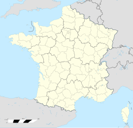
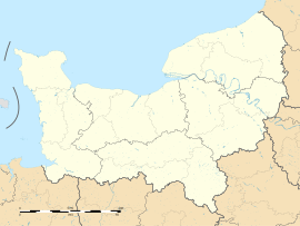
Champsecret (French pronunciation: [ʃɑ̃səkʁɛ] ) is a commune in the Orne department in north-western France.
Geography
[edit]The commune is made up of the following collection of villages and hamlets, La Chesnaie, Les Fourchets, La Botellerie, Le Hamel, Le Tertre, Pont de Pierre, La Noé, La Basse Verrerie, L'Ermitage and Champsecret.[3]
It is 4,470 hectares (17.3 sq mi) in size. The highest point in the commune is 215 metres (705 ft).
The commune is within the Normandie-Maine Regional Natural Park.[4] Champsecret along with the communes of Perrou, Les Monts d'Andaine, Juvigny Val d'Andaine, Dompierre and Domfront en Poiraie is part of the Bassin de l'Andainette a Natura 2000 conservation site.[5] The site measures 617 hectares and is home to creatures such as the Bullhead, Brook lamprey and white-clawed crayfish.[6]
The Andainette and the Varenne are the two rivers, running through this commune.
Points of interest
[edit]- Arboretum de l'Étoile des Andaines - Created in 1947 this arboretum features over 70 hardwood and Conifer trees.
National heritage sites
[edit]The Commune has four buildings and areas listed as a Monument historique.[7]
- Forges de Varennes the site features a blast furnace built in 1767, a refinery and a splitting mill, it was registered as a monument in 1987.[8]
- Champsecret Church a seventeenth century church, registered as a Monument historique in 1984.[9]
- Cross of the old cemetery a sixteenth century hexagonal granite cross, registered as a Monument historique in 1938.[10]
- Old manor a fourteenth century manor, registered as a Monument historique in 1926.[11]
Notable People
[edit]- Auguste-François Maunoury - (1811–1898) was a Catholic Hellenist and exegete, who was born here.[12]
- Louis Corbière - (1850 - 1941) a French botanist and mycologist was born here.[13]
- Charles Lucien Léandre - (1862–1934) was a French caricaturist and painter, who was born here, and later buried here.[14][15]
See also
[edit]References
[edit]- ^ "Répertoire national des élus: les maires". data.gouv.fr, Plateforme ouverte des données publiques françaises (in French). 9 August 2021.
- ^ "Populations légales 2021" (in French). The National Institute of Statistics and Economic Studies. 28 December 2023.
- ^ a b "Champsecret · 61700, France". Champsecret · 61700, France.
- ^ "rapport de charte" (PDF), parc-naturel-normandie-maine.fr/
- ^ "INPN - FSD Natura 2000 - FR2500119 - Bassin de l'Andainette - Description".
- ^ "Bassin de l'Andainette" (PDF). Ministère de la Transition écologique.
- ^ "Les Monuments Historiques en Orne - 61". monumentum.fr.
- ^ "Forges de Varennes à Champsecret - PA00110771". monumentum.fr.
- ^ "Eglise à Champsecret - PA00110770". monumentum.fr.
- ^ "Croix de l'ancien cimetière à Champsecret - PA00110769". monumentum.fr.
- ^ "Vieux manoir à Champsecret - PA00110772". monumentum.fr.
- ^ "Champsecret. La promotion de la ville se fait en peinture". alencon.maville.com.
- ^ "CTHS - CORBIÈRE Francois Marie Louis". cths.fr.
- ^ "Charles Lucien Léandré | Smithsonian American Art Museum". americanart.si.edu.
- ^ "61 - PATRIMOINE FUNERAIRE DE L'ORNE : Etat des lieux - Cimetières de France et d'ailleurs". www.landrucimetieres.fr.


