Cezura
Cezura | |
|---|---|
 | |
| Coordinates: 42°48′48″N 4°19′23″W / 42.81333°N 4.32306°W | |
| Country | |
| Autonomous community | |
| Province | |
| Comarca | Palentziako Mendialdea |
| Municipality | Pomar de Valdivia |
| Elevation | 888 m (2,913 ft) |
| Population (2020)[2] | |
| • Total | 10 [1] |
| Demonym | vivedense |
| Time zone | UTC+1 (CET) |
| • Summer (DST) | UTC+2 (CEST) |
| Postal code | 34813 |
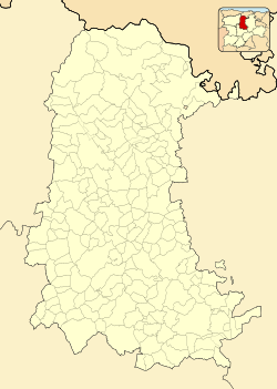
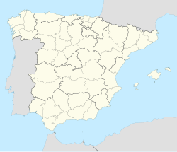
Cezura is a district and Spanish town of the municipality of Pomar de Valdivia, belonging to the province of Palencia, in the autonomous community of Castile and León. The town, which is located in the region of Montaña Palentina, constitutes a exclave of Palentina within Cantabria.
Geography
[edit]It is part of the province of Palencia, in Cantabria, specifically in the municipality of Valderredible.[3] Access via CA-273 and PP-6300.
History
[edit]The town belongs to the province of Palencia because in the Middle Ages it belonged to an abadengo lordship linked to Palencia, so in the provincial division it was integrated into this province and not into Cantabria.
After the fall of the Ancien Régime the locality became constitutional municipality[4] that in the census of 1842 it had 6 households and 31 neighbors. By the middle of the c. 19th century, the place had 7 houses counted.[5] It is described in the sixth volume of Pascual Madoz's Geographical-statistical-historical dictionary of Spain and its overseas possessions as follows:
CEZURA: l. with council in the province of Palencia (17 leg.), part. jud. of Cervera de Rio Pisuerga (5 1/2), dioc. de Burgos (12), aud. terr. and c. g. from Valladolid (25): sit. in a valley surrounded by slopes and bushes; The climate is cold and humid, due to the much snow that falls during the winter, and the winds that prevail most frequently are from the N. and S. It has 7 houses, a fountain within the population, and several in the term. of fresh and thin waters, and an igloo. parr., dedicated to Santiago Apóstol. Confine N. Munilla; E. Valdelomar; S. Elecha, and O. Quintanilla de las Torres. The terrain is hilly and bushy, and the little that is cultivated is of poor quality, with holm oaks being found in all places, although sparsely populated. The roads are from town to town, in very poor condition due to the nature of the soil; and the correspondence is received from Aguilar de Campó by the same interested parties. prod.: rye and oats; cattle and goats, and hunting partridges and hares in abundance. ind.: the agricultural one. pop.: 6 times, 31 alm. chap. prod.: 7,600 rs. imp.: 630. The municipal budget amounts to 360 rs., and is covered by the prod. of pastures and by neighborhood distribution.
— (Madoz 1847, p. 382)
Between the census of 1857 and the previous one, the municipality of Cezura disappeared when it was integrated into that of Villarén de Valdivia.
Demographics
[edit]| 2000 | 2001 | 2002 | 2003 | 2004 | 2005 | 2006 | 2007 | 2008 | 2009 | 2010 | 2011 | 2012 | 2013 | 2014 | 2015 | 2016 | 2017 | 2018 | 2019 | 2020 | 2021 | 2022 | 2023 ! |
|---|---|---|---|---|---|---|---|---|---|---|---|---|---|---|---|---|---|---|---|---|---|---|---|
| 39 | 41 | 44 | 40 | 38 | 38 | 45 | 47 | 49 | 52 | 52 | 47 | 48 | 44 | 40 | 38 | 44 | 40 | 43 | 47 | 43 | 46 | 45 | 45 |
References
[edit]- ^ "Instituto Nacional de Estadística. (Spanish Statistical Institute)". www.ine.es. Retrieved 2021-09-08.
- ^ Municipal Register of Spain 2018. National Statistics Institute.
- ^ Wikimapia,[1]
- ^ Municipality Code INE -345029
- ^ Madoz, Pascual (1847). Diccionario geográfico-estadístico-histórico de España y sus posesiones de ultramar. Est. Literario-Tipográfico de P. Madoz y L. Sagasti. p. 382.
- ^ Gazetteer: Population of the Continuous Register by Population Unit as of January 1.


