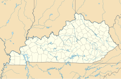
Bullittsville, Kentucky
Appearance
Bullittsville, Kentucky | |
|---|---|
| Coordinates: 39°04′31″N 84°44′19″W / 39.07528°N 84.73861°W | |
| Country | United States |
| State | Kentucky |
| County | Boone |
| Elevation | 771 ft (235 m) |
| Time zone | UTC-5 (Eastern (EST)) |
| • Summer (DST) | UTC-4 (EDT) |
| Area code | 859 |
| GNIS feature ID | 488375[1] |
Bullittsville is an unincorporated community in Boone County, Kentucky, United States.[1]
A post office called Bullittsville was established in 1853, and remained in operation until 1918.[2] The community has the name of Thomas Bullitt, a pioneer surveyor.[3]
Notes
[edit]- ^ a b "Bullittsville, Kentucky". Geographic Names Information System. United States Geological Survey, United States Department of the Interior.
- ^ "Boone County". Jim Forte Postal History. Retrieved June 15, 2017.
- ^ Fitzgerald, William (1962). "Place Names in Boone County" (PDF). p. 3. Retrieved June 15, 2017.

