Blessey
Appearance
Blessey | |
|---|---|
Part of Source-Seine | |
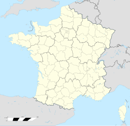
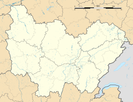
| Coordinates: 47°29′24″N 4°41′11″E / 47.49°N 4.6864°E | |
| Country | France |
| Region | Bourgogne-Franche-Comté |
| Department | Côte-d'Or |
| Arrondissement | Montbard |
| Canton | Montbard |
| Commune | Source-Seine |
| Area 1 | 7.51 km2 (2.90 sq mi) |
| Population (2006)[1] | 24 |
| • Density | 3.2/km2 (8.3/sq mi) |
| Time zone | UTC+01:00 (CET) |
| • Summer (DST) | UTC+02:00 (CEST) |
| Postal code | 21690 |
| Elevation | 354–506 m (1,161–1,660 ft) (avg. 500 m or 1,600 ft) |
| 1 French Land Register data, which excludes lakes, ponds, glaciers > 1 km2 (0.386 sq mi or 247 acres) and river estuaries. | |
Blessey (French pronunciation: [blɛsɛ]) is a former commune in the Côte-d'Or department in eastern France. On 1 January 2009, Blessey was merged with Saint-Germain-Source-Seine to form the new commune of Source-Seine.[2][3] Its population was 24 in 2006.[1]
Demographics
[edit]| Year | 1962 | 1968 | 1975 | 1982 | 1990 | 1999 | 2006 |
|---|---|---|---|---|---|---|---|
| Population | 25 | 21 | 20 | 32 | 30 | 27 | 24 |
| From the year 1962 on: No double counting—residents of multiple communes (e.g. students and military personnel) are counted only once. | |||||||
See also
[edit]References
[edit]- ^ a b c Populations légales 2006: Téléchargement du fichier d'ensemble, INSEE
- ^ "Arrêté du 30 septembre 2008 portant fusion de communes". Légifrance (in French).
- ^ Commune supprimée de Blessey, INSEE
- ^ Des villages de Cassini aux communes d'aujourd'hui: Commune data sheet Blessey, EHESS (in French).


