Berrow Green
Appearance
| Berrow Green | |
|---|---|
 Admiral Rodney public house | |
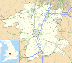
Location within Worcestershire | |
| OS grid reference | SO747582 |
| • London | 109 miles (175 km) |
| Civil parish |
|
| District | |
| Shire county | |
| Region | |
| Country | England |
| Sovereign state | United Kingdom |
| Post town | WORCESTER |
| Postcode district | WR6 |
| Dialling code | 01886 |
| Police | West Mercia |
| Fire | Hereford and Worcester |
| Ambulance | West Midlands |
Berrow Green is a village in Worcestershire, England.
Berrow Hill Camp
[edit]Berrow Green is situated just below Berrow Hill Camp, an Iron Age encampment or fort.[1][2]
References
[edit]- ^ Historic England & 1005332
- ^ Bowen 1952, p. 36
Sources
[edit]- Historic England (2015). "Berrow Hill Camp (1005332)". National Heritage List for England. Retrieved 13 July 2018.
- Bowen, AR (1952). "The Hill-Forts of Worcestershire and its Borders". Transactions of the Worcestershire Archaeological Society. New Series. XXIX: 33–37.
Wikimedia Commons has media related to Berrow Green.
