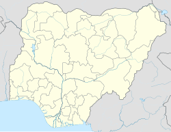
Bayo, Nigeria
Appearance
Bayo, Nigeria | |
|---|---|
| Coordinates: 10°16′22″N 11°39′41″E / 10.2729°N 11.6613°E | |
| Country | |
| State | Borno State |
| Population (2006) | |
| • Total | 78,978 |
| Time zone | UTC+1 (WAT) |
 | |
Bayo is a Local Government Area of Borno State, Nigeria. Its headquarters are in the town Fikayel.[1]
It has an area of 956 km2 and a population of 78,978 at the 2006 census.
The postal code of the area is 603.[2]
It is one of the four LGAs that constitute the Biu Emirate, a traditional state located in Borno State, Nigeria.[3]
Climate/Geography
[edit]Bayo LGA is located at an elevation of 2,500 feet above sea level and has a total size of 956 square kilometers. The terrain of the Bayo local government region, which is part of the Savannah belt, is made up of hills and other rock formations. The area's temperature is reported to be 33 degrees Celsius, with a 13% humidity level.[4][5][6]
References
[edit]- ^ "Governor Zulum, we need more secondary schools in Bayo LGA". Daily Trust. 2021-08-09. Retrieved 2022-11-19.
- ^ "Post Offices- with map of LGA". NIPOST. Archived from the original on 7 October 2009. Retrieved 2009-10-20.
- ^ Nigeria (2000). Nigeria: a people united, a future assured. Vol. 2, State Surveys (Millennium ed.). Abuja, Nigeria: Federal Ministry of Information. p. 106. ISBN 9780104089.
- ^ "Bayo Local Government Area". www.manpower.com.ng. Retrieved 2024-08-09.
- ^ "Bayo, Nigeria Hourly Weather Forecast | Weather Underground". www.wunderground.com. Retrieved 2024-08-09.
- ^ "10-Day Weather Forecast for Bayo, Borno, Nigeria - The Weather Channel | weather.com". The Weather Channel. Retrieved 2024-08-09.

