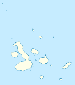
Baltra Island
| Geography | |
|---|---|
| Location | Galápagos Islands, Ecuador |
| Coordinates | 0°27′26″S 90°16′28″W / 0.457212°S 90.274332°W |
| Archipelago | Galápagos Islands |
| Administration | |

Baltra Island (Spanish: Isla Baltra) is a small island in the Galápagos Archipelago in Ecuador. It is a small flat island located near the center of the chain and includes Seymour Airport (GPS), originally established by the United States Air Force to help monitor and protect western access to the Panama Canal. Baltra is not part of the Galápagos National Park but some effort has been made to protect the local environment, including modernization of the airport and the reintroduction of the island's land iguanas.
Names
[edit]Baltra is a Spanish surname particularly common in Chile, but no records are known that explain which person was the namesake for the island. It is first attested in the form Isla Baltra in the British Admiralty's 1927 South America Pilot,[1] having been added at some point after the first 1915 edition. The Admiralty copy of the 1915 pilot bears the handwritten notation "Names. __ Baltra I. & Puerto Nuñez H 214/15" indicating that the names should be added to the next edition on the basis of the information in a document filed as "H 214/15", but this document cannot be found and is presumed lost.[2]
The island had previously been known as South Seymour in honor of the British naval officer Hugh Seymour,[3] who served during the Napoleonic Wars. Together with the neighboring North Seymour Island, Baltra is still sometimes known as the Seymours or the Seymour Group.
Geography
[edit]Baltra was created by geological uplift.
Flora
[edit]Baltra is very arid and vegetation consists of salt bushes, prickly pear cactus and palo santo trees.
Wildlife
[edit]Baltra is not within the boundaries of the Galápagos National Park. The Galápagos land iguana is the subject of an active reintroduction campaign on the island. The American Captain G. Allan Hancock moved a population of the iguanas to North Seymour Island in the early 1930s ahead of the construction of the US air base on Baltra. The development of Baltra led to the local population's extinction by 1954 but the North Seymour colony thrived and became the breeding stock for the successful Charles Darwin Research Station captive breeding program in the 1980s. In the 1990s, the land iguanas were reintroduced to Baltra. As of 1997, the new colony comprised 97 iguanas, 13 of which were born on Baltra.
Transport
[edit]Seymour Airport was established by the United States Air Force during World War II. Aircraft stationed at Seymour patrolled the Eastern Pacific for Japanese and German submarines, particularly on the routes to the Panama Canal. The facilities were transferred to the government of Ecuador after the war. The old airfield and the foundations of buildings from the US base are still visible, but the field has been moved and modernized. Since 1986, air travel to the Galápagos has been shared with San Cristóbal Airport on San Cristóbal Island but private planes must fly to Seymour as it is the only airport with overnight facilities for planes. Seymour also continues service as a base for the Ecuadorian Air Force. The most recent modernization began in 2011 and was completed in 2013, after which ECOGAL,[4] a subsidiary of the Argentinian Corporación América,[5] will enjoy a 15-year concession to the location.[6] ECOGAL has promoted the new airport as the "first ecological airport worldwide" due to various improvements to its energy consumption, rainwater recovery, waste recycling, and so on.[7]
Visitors arriving at Seymour are driven by bus to two docks, one located by a small bay where tour boats away passengers and the second the dock on the Itabaca Channel for the ferry to Santa Cruz.
References
[edit]Citations
[edit]- ^ UKHO (1927), p. 358.
- ^ Woram, John (2016), "Part III: Island and Other Place Names", Las Encantadas: Human and Cartographic History of the Galápagos Islands.
- ^ McEwen (1988), p. 238.
- ^ Official website (in Spanish), ECOGAL.
- ^ Official website (in Spanish), Corporación América, archived from the original on 2013-05-13.
- ^ "Aeropuerto Ecológico Galápagos: About us". ECOGAL. Retrieved 21 May 2013.
- ^ "Aeropuerto Ecológico Galápagos: Sustainable building". ECOGAL. Retrieved May 21, 2013.
Bibliography
[edit]- South America Pilot (2nd ed.), Taunton: Hydrographic Department, 1927.
- McEwen, Alec (July 1988), "The English Place-Names of the Galápagos", The Geographical Journal, vol. 154, London: Royal Geographical Society, pp. 234–242, doi:10.2307/633849, JSTOR 633849.
