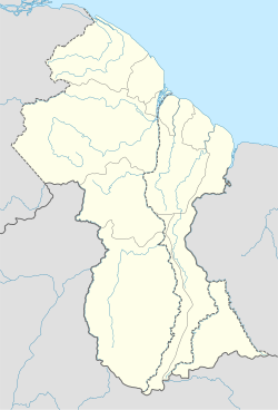
Awarewaunau
Awarewaunau | |
|---|---|
Village | |
| Coordinates: 2°38′33″N 59°11′31″W / 2.6426°N 59.1919°W | |
| Country | |
| Region | Upper Takutu-Upper Essequibo |
| Government | |
| • Toshao | Johnny Duncan (2012-)[1] |
| Area | |
• Total | 782.0 km2 (301.93 sq mi) |
| Population (2021)[1] | |
• Total | c. 600 |
Awarewaunau (also: Awaruwaunawa[2]) is a village in the Upper Takutu-Upper Essequibo Region of Guyana. Awarewaunau is inhabited by Wapishana Amerindians.[1]
Overview
[edit]In 1909 missionaries arrived in the area.[3] Awarewaunau was founded in the 1920s.[1] The name is Wapishana and means Windy Creek Hill.[3] The main religion of the villagers is Christian.[1]
The economy of Awarewaunau is based on subsistence farming and livestock. The village has a primary school and a health centre.[1] Secondary education is offered in Aishalton.[4] As of 2019, the village is connected to the internet.[5] In 2018, water wells were constructed in the village as part of a joint exercise of the Brazilian Army and the Guyana Defence Force.[6]
Transport
[edit]Awarewaunau is served by the Awaruwaunau Airport.[7] In 2018, a contract was awarded to construct a road from Lethem to Shea via Awarewaunau.[8]
Nature
[edit]Awarewaunau is on the edge of a large pristine rainforest which is home to cock-of-the-rocks, harpy eagles, and bush dogs.[3] The forest is part of the Wapichan Conserved Forest, a planned 1,400 square kilometres (540 sq mi) protected area.[9]
References
[edit]- ^ a b c d e f g "Awarewaunau". Ministry of Indigenous Affairs. Archived from the original on 27 February 2021. Retrieved 30 November 2021.
- ^ "Indigenous officers fulfilling dream in police force". Guyana Chronicle via University of Florida. 5 July 2006. p. 16. Archived from the original on 30 November 2021. Retrieved 30 November 2021.
- ^ a b c "Awarewaunau village". Community Lands. Archived from the original on 26 February 2018. Retrieved 30 November 2021.
- ^ "El Nino bakes South Rupununi". Stabroek News. Archived from the original on 30 November 2021. Retrieved 30 November 2021.
- ^ "eGovernment ICT Hubs connected to the eGovernment Network". National Datamanagement Authority. Archived from the original on 20 April 2021. Retrieved 30 November 2021.
- ^ "Sixth water well successfully drilled in Region 9". iNews Guyana. 27 October 2018. Archived from the original on 15 January 2021. Retrieved 30 November 2021.
- ^ "SYAW - Facility". GC Map. Archived from the original on 5 September 2017. Retrieved 30 November 2021.
- ^ "Cabinet notes the awarding of 27 multi-million contracts". Kaieteur News. Archived from the original on 3 December 2018. Retrieved 30 November 2021.
- ^ "Wapichan people in Guyana showcase community proposal to save tropical forests on their traditional lands". 7 February 2012. Archived from the original on 8 May 2021. Retrieved 30 November 2021.
