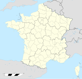
Auberives-en-Royans
Auberives-en-Royans | |
|---|---|
 The Town Hall | |
| Coordinates: 45°03′51″N 5°18′07″E / 45.0642°N 5.3019°E | |
| Country | France |
| Region | Auvergne-Rhône-Alpes |
| Department | Isère |
| Arrondissement | Grenoble |
| Canton | Le Sud Grésivaudan |
| Intercommunality | Saint-Marcellin Vercors Isère Communauté |
| Government | |
| • Mayor (2020–2026) | Stéphane Villard[1] |
Area 1 | 5.07 km2 (1.96 sq mi) |
| Population (2021)[2] | 368 |
| • Density | 73/km2 (190/sq mi) |
| Time zone | UTC+01:00 (CET) |
| • Summer (DST) | UTC+02:00 (CEST) |
| INSEE/Postal code | 38018 /38680 |
| Elevation | 170–330 m (560–1,080 ft) |
| 1 French Land Register data, which excludes lakes, ponds, glaciers > 1 km2 (0.386 sq mi or 247 acres) and river estuaries. | |
Auberives-en-Royans (French pronunciation: [obʁiv ɑ̃ ʁwajɑ̃]; Occitan: Aubaribas de Roians) is a commune in the Isère department in the Auvergne-Rhône-Alpes region of south-eastern France.
Geography
[edit]Auberives-en-Royans is located at the foot of the Vercors plateau in the Isère valley some 19 km east of Romans-sur-Isère and 11 km south of Saint-Marcellin. The southern border of the commune is the border between Isère and Drôme departments. Access to the commune is by the D531 road which branches from the D1532 east of Saint-Nazaire-en-Royans which passes through the south of the commune and the village and continues along the southern border east to Pont-en-Royans. The D518 road comes from Saint-Romans in the north and passes down the eastern border of the commune to Pont-en-Royans. The commune has some forests in the north and the rest is farmland.[3]
The southern border of the commune consists entirely of the Bourne river as it flows west to join the Isère at Saint-Nazaire-en-Royans. The Tarze river flows through the centre of the commune from the north and joins the Bourne near the village. The Canal de la Bourne starts in the south-west of the commune and flows through the commune parallel to the Bourne towards the Isère.[3]
Neighbouring communes and villages
[edit]Administration
[edit]List of Successive Mayors[4]
| From | To | Name |
|---|---|---|
| 2008 | 2014 | Bernard Perazio |
| 2014 | 2026 | Stéphane Villard |
Demography
[edit]The inhabitants of the commune are known as Albaripains or Albaripaines in French.[5]
|
| ||||||||||||||||||||||||||||||||||||||||||||||||||||||||||||||||||||||||||||||||||||||||||||||||||||||||||||||||||
| |||||||||||||||||||||||||||||||||||||||||||||||||||||||||||||||||||||||||||||||||||||||||||||||||||||||||||||||||||
| Source: EHESS[6] and INSEE[7] | |||||||||||||||||||||||||||||||||||||||||||||||||||||||||||||||||||||||||||||||||||||||||||||||||||||||||||||||||||
Sites and monuments
[edit]- A Church from the 19th century
- A Fortified house
See also
[edit]References
[edit]- ^ "Répertoire national des élus: les maires". data.gouv.fr, Plateforme ouverte des données publiques françaises (in French). 2 December 2020. Archived from the original on 28 June 2020. Retrieved 7 May 2024.
- ^ "Populations légales 2021" (in French). The National Institute of Statistics and Economic Studies. 28 December 2023.
- ^ a b c Google Maps
- ^ List of Mayors of France Archived 23 May 2014 at the Wayback Machine (in French)
- ^ Le nom des habitants du 38 - Isère Archived 8 December 2015 at the Wayback Machine, habitants.fr
- ^ Des villages de Cassini aux communes d'aujourd'hui: Commune data sheet Auberives-en-Royans, EHESS (in French).
- ^ Population en historique depuis 1968 Archived 24 September 2022 at the Wayback Machine, INSEE
External links
[edit]- Auberives-en-Royans on Géoportail, National Geographic Institute (IGN) website (in French)
- Anberive en Royans on the 1750 Cassini Map


