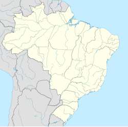
Angatuba
Angatuba | |
|---|---|
 Location in São Paulo state | |
| Coordinates: 23°29′25″S 48°24′46″W / 23.49028°S 48.41278°W | |
| Country | Brazil |
| Region | Southeast |
| State | São Paulo |
| Area | |
• Total | 1,028 km2 (397 sq mi) |
| Population (2020 [1]) | |
• Total | 25,479 |
| • Density | 25/km2 (64/sq mi) |
| Time zone | UTC−3 (BRT) |
Angatuba is a Brazilian municipality in the state of São Paulo. The population is 25,479 (2020 est.) in an area of 1028 km².[2] The highway Rodovia Raposo Tavares passes south of the city.
There is controversy about the meaning of the name Angatuba. It is a Tupi-Guarani word for "house of spirits" or "sweet fruit".[3] Angatuba was founded in 1872, under the name Espírito Santo da Boa Vista. It became a town (vila) and an independent municipality in 1885, when it was separated from Itapetininga. It was elevated to a city (cidade) in 1906. The name was changed to Angatuba in 1908. In 1991 Campina do Monte Alegre was separated from Angatuba.[3]
The municipality contains the 1,394 hectares (3,440 acres) Angatuba Ecological Station, a fully protected conservation unit created in 1985. The ecological station is contained within the Angatuba State Forest.[4] This is a 1,196.21 hectares (2,955.9 acres) sustainable use conservation unit created in 1965.[5]
Media
[edit]In telecommunications, the city was served by Companhia de Telecomunicações do Estado de São Paulo until 1975, when it began to be served by Telecomunicações de São Paulo.[6] In July 1998, this company was acquired by Telefónica, which adopted the Vivo brand in 2012.[7]
The company is currently an operator of cell phones, fixed lines, internet (fiber optics/4G) and television (satellite and cable).[7]
Notable people
[edit]- João Francisco Benedan, vocalist and main member of Brazilian punk rock band Ratos de Porão
- Suzane von Richthofen, notorious convicted murderer[8]
References
[edit]- ^ IBGE 2020
- ^ Instituto Brasileiro de Geografia e Estatística
- ^ a b IBGE, history
- ^ ESEC de Angatuba (ESEC) (in Portuguese), ISA: Instituto Socioambiental, retrieved 2016-06-30
- ^ Angatuba (in Portuguese), Secretaria do Meio Ambiente - Instituto Florestal, retrieved 2016-07-01
- ^ "Creation of Telesp - April 12, 1973". www.imprensaoficial.com.br (in Portuguese). Retrieved 2024-05-26.
- ^ a b "Our History - Telefônica RI". Telefônica. Retrieved 2024-05-26.
- ^ "Suzane von Richthofen se muda para Angatuba após deixar prisão em Tremembé, SP" (in Brazilian Portuguese). G1. 19 January 2023. Retrieved 8 February 2023.
External links
[edit]- (in Portuguese) City Hall
- (in Portuguese) House of Representatives


