Aaqbe
Aaqbe
العقبه Akbeh, Aqbe, Akbe, Aqbeh, Aaqabet, el-Aaqbe, Akraba, Aaqabet Rashaya, Akabe | |
|---|---|
Village | |
 | |
| Country | |
| Governorate | Beqaa Governorate |
| District | Rashaya District |
| Alternative name | Akbeh, Aqbe, Akbe, Aqbeh |
|---|---|
| Location | 3 kilometres (1.9 mi) west of Rashaya |
| Region | Rashaya |
| Coordinates | 33°30′18″N 35°49′16″E / 33.5051°N 35.8211°E |
| History | |
| Cultures | Roman |
| Site notes | |
| Condition | Ruins |
| Public access | Yes |
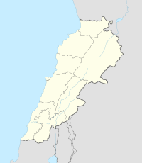
Aaqbe, Akbeh, Aqbe, Akbe, Aaqabet, el-Aaqbe, Akraba, Aaqabet Rashaya or Akabe (العقبه) is a village and municipality situated 3 kilometres (1.9 mi) west of Rashaya in the Rashaya District of the Beqaa Governorate in Lebanon.[1][2]
Roman temple
[edit]The village contains the vestiges of a Roman temple, one of Mount Hermon group of temples . The temple is situated on a hill with a commanding view of Mount Hermon. George F. Taylor classified it as an Antae temple of a rugged design that lacked decoration. He noted that the doorway of the temple does not face the summit; it aligns instead to a northerly area of the mountain that is covered by a ridge. The temple featured a niche that may have housed a cult statue of which only the framing columns have survived. Three sections of the east antae pillar were also still in place.[1]
References
[edit]- ^ a b George Taylor (1971). The Roman temples of Lebanon: a pictorial guide. Les temples romains au Liban; guide illustré. Dar el-Machreq Publishers. Retrieved 19 September 2012.
- ^ Daniel M. Krencker; Willy Zschietzschmann (1938). Römische Tempel in Syrien: nach Aufnahmen und Untersuchungen von Mitgliedern der Deutschen Baalbekexpedition 1901-1904, pp. 205-269 & pl, 83-116, Otto Puchstein, Bruno Schulz, Daniel Krencker. W. de Gruyter & Co. Retrieved 17 September 2012.
Bibliography
[edit]- Ted Kaizer (2008). The Variety of Local Religious Life in the Near East In the Hellenistic and Roman Periods. BRILL. pp. 319–. ISBN 978-90-04-16735-3. Retrieved 19 September 2012.


