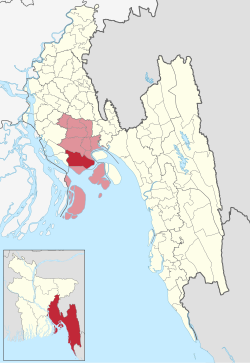
Subarnachar (Bengali: সুবর্ণচর, romanized: Shubornochor) is an upazila (sub-district) of the Noakhali District, located in Bangladesh's Chittagong Division.[3] The Bhulua River and Sandwip Channel flows through it. A number of Subarnachar residents have migrated to Oman where they form a small diaspora community.[4]
Subarnachar
সুবর্ণচর উপজেলা | |
|---|---|
 | |
| Coordinates: 22°41′N 91°6.6′E / 22.683°N 91.1100°E | |
| Country | |
| Division | Chittagong |
| District | Noakhali |
| Government | |
| • MP (Noakhali-4) | Ekramul Karim Chowdhury |
| • Upazila Chairman | AHM Khayrul Anam Chowdhury |
| Area | |
| • Total | 575.47 km2 (222.19 sq mi) |
| Population | |
| • Total | 355,910 |
| • Density | 620/km2 (1,600/sq mi) |
| Time zone | UTC+6 (BST) |
| Postal code | 3812 (Charjabbar)[2] |
| Postal code | 3813 (Charbata)[2] |
| Website | subarnachar |
History
editThe islands in the upazila formed in 1959 and many poor migrants started settling there. This was followed by a land dispute in 1986 with foreign land grabbing forces. The clashes killed hundreds of people and destroyed thousands of homes. The settlers of Subarnachar sacrificed many precious lives to survive on that day. The history of this upazila has been written through the relentless struggle of the working people who have made this salty char habitable through their creative activities. Subarnachar has suffered from flooding in many occasions such as on 12 November 1970 as well as in 1985, 1991 and 1998. Subarnachar was given upazila status on 2 April 2005, taking 7 unions from Noakhali Sadar Upazila.[5]
Demographics
editAccording to the 2011 Census of Bangladesh, Subarnachar Upazila had 55,399 households and a population of 289,514. 94,114 (32.51%) were under 10 years of age. Subarnachar had a literacy rate (age 7 and over) of 32.66%, compared to the national average of 51.8%, and a sex ratio of 1017 females per 1000 males. 6,651 (2.30%) lived in urban areas.[7][8]
Administration
editSubarnachar Upazila is divided into eight union parishads: Charamanullah, Charbata, Charjabbar, Charjubilee, Charklark, Charwapda, East Charbata, and Mohammadpur. The union parishads are subdivided into 52 mauzas and 53 villages.[9]
Upazila Chairmen
edit| Name | Term |
|---|---|
| AFM Fakhrul Islam Munshi | 1985-1986 |
| Abul Bashar Bhuiyan | 1986-1991 |
| AHM Khayrul Anam Chowdhury Charbati | Present |
Education
editThe average literacy rate of Subarnachar is 32.83%; with males at 37.50% and females at 28.15%. There are many notable institutions in Subarnachar. There are 241 mosques and 12 madrasas including the Char Jubilee Rabbania Fazil Madrasa and the Char Bata Islamia Alim Madrasa.
See also
editReferences
edit- ^ National Report (PDF). Population and Housing Census 2022. Vol. 1. Dhaka: Bangladesh Bureau of Statistics. November 2023. p. 397. ISBN 978-9844752016.
- ^ a b "Bangladesh Postal Code". Dhaka: Bangladesh Postal Department under the Department of Posts and Telecommunications of the Ministry of Posts, Telecommunications and Information Technology of the People's Republic of Bangladesh. 20 October 2024.
- ^ "600 SIs for separate probe unit soon". The Daily Star. UNB. 30 January 2005. Retrieved 28 September 2015.
- ^ Kuri, Ranajit (2 December 2020). "3 Bangladeshis electrocuted in Oman". Dhaka Tribune. Noakhali.
- ^ Rita, Tahera Begum (2012). "Subarnachar Upazila". In Sirajul Islam; Miah, Sajahan; Khanam, Mahfuza; Ahmed, Sabbir (eds.). Banglapedia: the National Encyclopedia of Bangladesh (Online ed.). Dhaka, Bangladesh: Banglapedia Trust, Asiatic Society of Bangladesh. ISBN 984-32-0576-6. OCLC 52727562. OL 30677644M. Retrieved 14 November 2024.
- ^ Population and Housing Census 2022 - District Report: Noakhali (PDF). District Series. Dhaka: Bangladesh Bureau of Statistics. June 2024. ISBN 978-984-475-274-0.
- ^ "Community Tables: Noakhali district" (PDF). bbs.gov.bd. Bangladesh Bureau of Statistics. 2011.
- ^ "Bangladesh Population and Housing Census 2011 Zila Report – Noakhali" (PDF). bbs.gov.bd. Bangladesh Bureau of Statistics. 2011.
- ^ "District Statistics 2011: Noakhali" (PDF). Bangladesh Bureau of Statistics. Archived from the original (PDF) on 13 November 2014. Retrieved 14 July 2014.